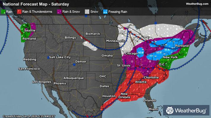
Flooding Rain, Gusty Thunderstorms Target the South
A slow-moving cold front will bring rounds of heavy rain and gusty thunderstorms across the South today into Saturday.
Ahead of this front, unseasonably warm and humid conditions are in place from Texas to Alabama today, with temperatures in the upper 60s and lower 70s already this morning. But behind this front, temperatures in the 30s and 40s are found not too far to the west.
This collision of air masses will result in rounds of heavy rainfall and potentially strong, gusty thunderstorms across the southern U.S. today.
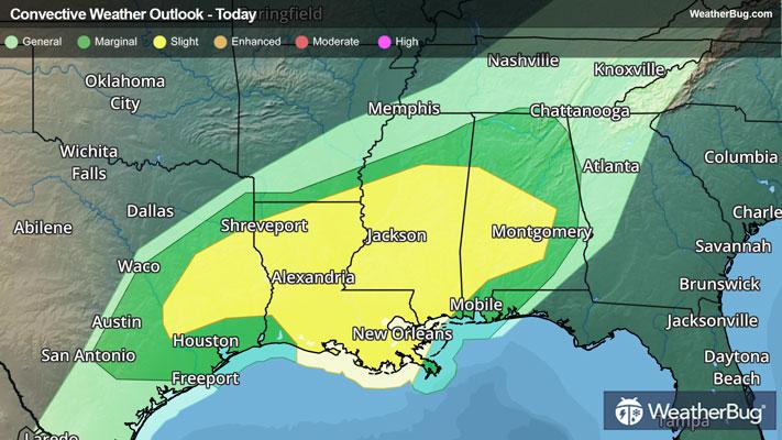
The government's Storm Prediction Center has issued a Slight Risk, or a 2 out of 5 on the severe weather probability scale, from eastern Texas to western Alabama for today. This includes cities such as Lufkin, Texas, New Orleans, and Jackson, Miss.
Heavy rain, damaging wind gusts, and large hail will be the primary threats from thunderstorms today. However, an isolated tornado or two cannot be ruled out. A Tornado Watch has been issued for central Louisiana into south-central Mississippi.
In addition to the severe thunderstorm threat, rounds of moderate to occasionally heavy rainfall will be likely today into Saturday, especially across eastern Louisiana, Mississippi, Alabama northern Georgia, and central Tennessee. Here, Flood Watches have been issued as one to 3 inches of rainfall will be possible from repeated rounds of showers and thunderstorms. Localized rain amounts of 4 to 5 inches will be possible, especially across the southern half of Mississippi into eastern Louisiana. Remember, if you approach a roadway covered in water, follow a simple motto – “Turn Around, Don’t Drown!”
Make sure to know the difference between a watch and a warning should they become issued. A watch means that conditions are favorable for severe weather to occur and to be on alert for any rapidly changing conditions. A warning means that severe weather is imminent, and you should act fast to remain safe.