Gusty Thunderstorms Rumble Across the Gulf Coast
Gusty thunderstorms and perhaps a tornado will be possible across parts of the Gulf Coast today.
A cold front will continue to press eastward today across the southern states. Warm and humid conditions ahead of this front will collide with a cooler, drier air mass following this front.
The collision of these two air masses will result in a line of strong to severe thunderstorms today. Thunderstorms will be capable of producing damaging winds and heavy downpours, while an isolated tornado cannot be ruled out.
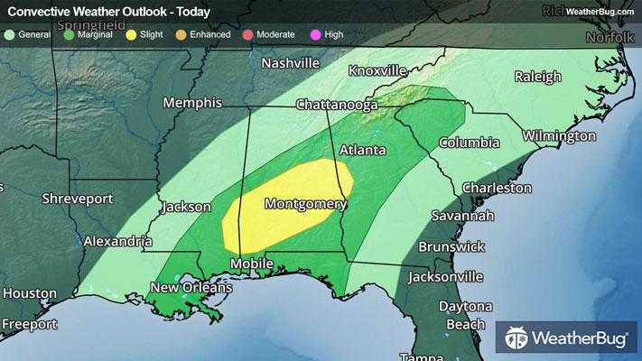
The government's Storm Prediction Center has issued a Slight Risk, or a 2 out of 5 on the severe weather probability scale, across parts of Mississippi, Alabama, and Georgia. A few stronger thunderstorms may also move through southeastern Louisiana, including New Orleans, and farther to the northeast, including Atlanta and western portions of South Carolina.
Flood Watches remain in place across portions of Alabama and northwestern Georgia. Localized rain fall totals up to 2 inches, most of which is expected to fall in a short period of time, will be possible within these areas. Remember, if you approach a roadway covered in water, follow a simple motto – “Turn Around, Don’t Drown!”
Make sure to know the difference between a watch and a warning should they become issued. A watch means that conditions are favorable for severe weather to occur and to be on alert for any rapidly changing conditions. A warning means that severe weather is imminent, and you should act fast to remain safe.