Back to forecast
The Northeast Gears Up for Dangerous Weather
September 4, 2019 at 06:49 PM EDT
UPDATED By WeatherBug's Erik Gates
Labor Day may be long gone, but summer storms will persist across the Northeast today. Afternoon showers and strong thunderstorms will begin to fire off as a cold front brreezes through from Pennsylvania to Maine.
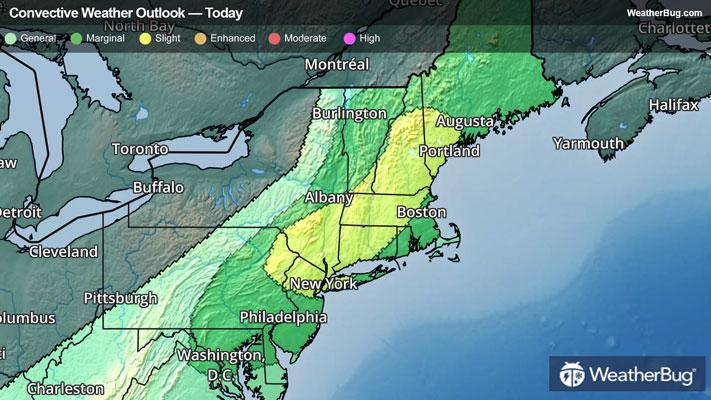
Some of the locations that will see the highest threats include New York City, Boston, Hartford, Conn., and Portland, Maine.
A Severe Thunderstorm Watch has been issued for northeastern Pennsylvania into New Jersey, New York, Conneticut, and Rhode Island. Cities within this watch are Allentown, Pa., New York City, Albany, N.Y., Hartford, Conn, and Providence, R.I. These locations will need to watch for damaging wind gusts up to 70 mph, hail the size of golf balls, and briefly blinding downpours.
Just yesterday, around a dozen reports of damaging wind in thunderstorms came out of the Great Lakes as this same front moved through. One person was even injured in Beach Park, Ill. as a car was flipped over.
If you have any plans to be outdoors this afternoon or evening, or will be doing any driving, be sure to pay attention for rapidly changing skies signaling bad weather ahead.
Keep in mind that lightning is one of Mother Nature's most dangerous killers. If you can hear thunder, you are close enough to the storm to be struck by lightning, even if the sun is shining.
Don’t drive through any flooded roadways if you encounter high water. Remember to ‘Turn around, don’t drown.’ It could save your life.