How Does Hail Form?
The sound of hail plunking car hoods is synonymous with summer thunderstorms, but many wonder, what causes meteor-sized balls of ice to fall in the heat of summer in the first place.
Hail is a seemingly unusual event; ice falling from the sky during a hot summer day seems impossible. However, the fact is, hail begins as a normal rain droplet, just like the ones that fall during your average spring or summer thunderstorm.
Severe thunderstorms feature massive, billowing cumulonimbus clouds. These towering anvil-shaped clouds are generated by rising air and can reach heights in excess of 40,000 feet. The same pockets of rising air that help the cloud grow are also responsible for transforming raindrops into icy projectiles.
Rain droplets exist at levels within clouds where warm air is present, generally toward the base of the cloud. At the top of massive storm clouds, temperature readings can dip as low as -60 to -75 degrees Fahrenheit. Updrafts come into play by forcing liquid rain droplets upward into the colder regions of the clouds. The rain droplet is eventually pushed to a height where it becomes super-cooled, meaning it remains a liquid at a temperature below the freezing point.
Eventually, the super-cooled droplets come into contact with condensation nuclei, which are generally tiny atmospheric aerosols such as dust, soot or even sea spray. The droplets freeze on contact with the particle producing a tiny ball of ice. The storms updraft continues to force the newly formed ice crystals upward. As it rises, it encounters more super-cooled water droplets, which freeze on contact. More and more super-cooled droplets accrete on the frozen droplet as it rises, causing the ball of ice to grow in size.
Hailstones feature rings just like trees, these rings are caused by differences in temperature at different levels within a cloud. If the accretion is occurring in areas of warmer temperatures, air can escape, and the ice layer will be clear. In contrast, at colder temperatures, the air is trapped by the rapid freeze, producing a layer of opaque ice. Also, forming hailstones are certainly not always symmetrical spheres. The spinning and random motions of the stones within the cloud can cause ice to accrete more heavily on one side of the hailstone or the other. The hailstones can even feature points or spikes.
The size of a hailstone is correlated with the strength of the updraft. Stronger updrafts are able to push hailstones higher into the cloud, allowing for more ice accretion. This makes sense as hail is more frequently seen in powerful storms known as super cells, which tend to contain stronger updrafts than normal storms.
However, in the end, gravity wins out. The hailstone becomes so heavy that the rising air can no longer support it and it plummets to the Earth at speeds of up to 106 mph. At these speeds the stones can easily reach the ground without melting in the balmy summer air of the lower atmosphere.
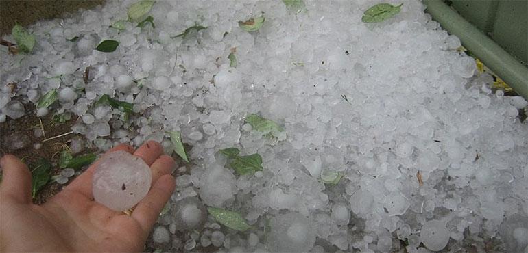
While hailstones in the U.S. are usually less than .75 inches, about the size of a penny, they can grow to a diameter as big as a CD, causing injuries and massive damage to automobiles and homes. In 2018, hail alone caused around $810 million in damage in the U.S., and in hyperactive years such as 2016, damage totals can reach several billion dollars.
So always be sure keep an eye out for severe watches and warnings if storms are expected to be in your area, as they can save both property and lives.