Pineapple Express Slams Northwestern U.S.

While the Northwest is still damp from the effect of last week's record-breaking atmospheric river, this week’s pineapple express will not let up on heavy rain, snowfall, brisk winds, and storm systems breaching its plethora of mountain ranges.
A conveyor belt of Aleutian low pressure systems is in place off of the Alaskan coast, with these lows continuing to intensify into the Pacific Northwest's coastline. Further south, tropical moisture is being catapulted by a central Pacific low and a high pressure system off of the coast of California, sending copious amounts of water vapor into the Northwest. In tandem, each of these features are working to mold quite a workweek for the region.
Ongoing in Washington and Oregon is a strong burst of winds and moisture as a cold front pushes overhead, bringing the strongest impacts of this event so far through the morning today. Snow levels are lowering behind the cold front, allowing for notable accumulation in the mid-elevations of the Northwest. A relative lull in rainfall is expected through the afternoon and evening on Wednesday, but impacts will still be prevalent, especially across the ridges, before another large burst of moisture squeezes out on Thursday.
In the near term, rain totals through Thursday are expected to commonly reach 1 to 2 inches along the coastline and lowlands west of the Cascades. Ahead of the coastal ranges, 2 to 3 inches are possible, and amongst the Cascades and costal ranges, totals of 3 to 4 inches will inundate the valleys.
Snow additions through Thursday will generally reach rather far downslope until Thursday evening. Before then, as low as 2000-3000 foot snow levels are expected, while deep accumulation builds onto the peaks with enhanced snow ratios. Two to 6 inches are expected in the northern Rocky mid-elevations and central Rockies, as well as the mid-to-lower elevations of the Olympics and Cascades, with 6 to 12 inches along most of the Olympic and Cascade mid-elevations and along most ridges of the northern Rockies. The higher peaks of the interior Northwest and Oregon Cascades will push well over a foot in additional snowpack. However, in Washington's Cascades and Olympics, snow accumulations will stack higher than two feet, with the most northerly peaks of the Cascades breaking in at over four feet!
Currently, Flood Watches are posted for portions of western Washington, northwestern Oregon, northern Idaho, and far northwestern Montana. Blizzard Warnings are posted for higher elevations of the Olympic Peninsula and northern Washington's Cascades. Still impactful Winter Storm Warnings are in effect for portions of northwestern Montana and western Wyoming, and Winter Weather Advisories litter Oregon's northern Cascades and northeastern ranges, Washington's southern Cascades, east-central Idaho, southwestern Montana, and the Front range between southern Wyoming and northern Colorado.
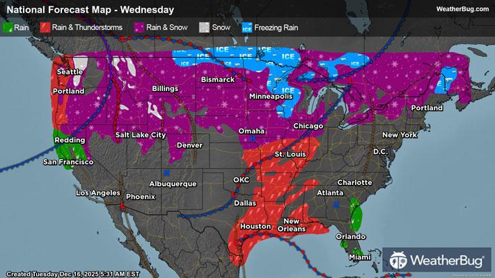
Winter Storm Watches are in effect for portions of central Idaho as well as the far northern Plains from parts of the Dakotas into northern Minnesota.
High winds are also expected to slam through the Northwest in the coming days, especially for the higher elevations, where some areas are expecting gusts of 50 to even 75 mph or higher alongside 25 to 45 mph sustained winds at times!
Over a much greater area, High Wind Warnings and Wind Advisories cover much of the Northwest, the northern and central Rockies, the Rocky Front Range, and the northern half of the High Plains.
Although this atmospheric river is expected to be weaker than its predecessor, its impacts will still be widespread. River and flash flooding is possible through the day today, with major concerns for rockslides and mudslides from already saturated and unstable landscapes. Gusty winds could down trees and powerlines, and mountain passes along the Cascades will not be navigable at times in low visibility and rapid wind gusts of 40 to 75 mph or greater. These conditions will pair at times with significant snow totals in the higher mountain passes to create blizzard conditions.
As the week moves forward, another great push from the atmospheric river is expected on Thursday and Friday, with the greatest impacts in western Oregon and northern California. Snow levels are expected to rise again late Thursday behind a warm front before dropping again on Friday behind yet another cold front.
Be sure to download the WeatherBug app to stay up to date on the latest on this changing weather. It’s never too early to have a supply kit packed in case of inclement weather. A simple kit including a weather radio, water, blankets, batteries, and non-perishable food items will go a long way in the event of a power outage.