Back to forecast
Severe Storms Threaten Tennessee Valley, Deep South
December 29, 2021 at 11:59 PM EST
By WeatherBug's Intern Meteorologist, Christopher Smith
After an already active month of severe weather, dangerous storms have targeted the Deep South and Tennessee Valley.
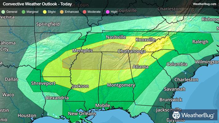
The combination of an upper-level disturbance and warm, moist spring-like air is providing fuel for storms to fire this evening in northern Mississippi, Alabama and eastern Tennessee. Aided by a weak cold front, storms have organized into a line and gained just enough strength to become severe.
A Tornado Watch is in effect for east-central Alabama, central Georgia, northwestern South Carolina inot southwestern North Carolina. The Storm Prediction Center has placed an Enhanced Risk for severe thunderstorm development over this region. This includes the cities of Alexander City, Ala., Atlanta and Athens, Ga., and Anderson and Greenville, S.C.
Other cities at risk for severe storms overnight include Montgomery, Ala., Columbus and Macon, Ga., and Charlotte, N.C. Besides tornadoes, damaging wind gusts more than 60 mph and hail larger than the size of quarters are possible. In addition to severe weather, repeated rounds of rain could produce minor flooding tonight.
Make sure you know the difference between a watch and warning should they be issued. A watch means that the ingredients for severe weather are present, and you should have a plan in place for acting. A warning means that severe weather is imminent, and you need to act fast to protect life and well-being. Remember the phrase, "When Thunder Roars, Go Indoors!"