Severe Thunderstorms Predicted for East Texas & Lower Mississippi Valley
Severe weather is unusual in the middle of winter, but ingredients will come together to produce stormy weather over East Texas and the Lower Mississippi Valley today.
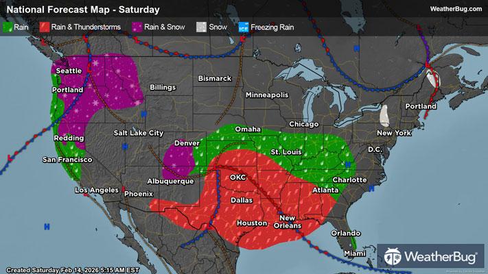
A low pressure system tracking across the lower Plains will carry moisture and energy to aid in the development of severe thunderstorms through much of the day today. A line of thunderstorms present already over central Texas could contain a stronger gust or large hail, but its not until later this evening this line of storms will really begin to ramp up.
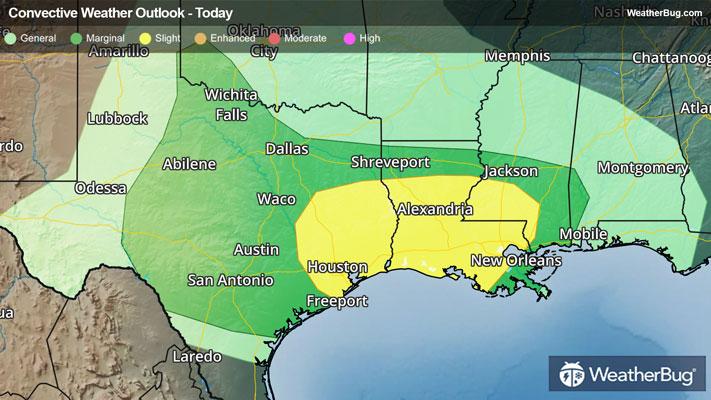
The Storm Prediction Center has overlayed a Slight Risk for severe thunderstorms from southeastern Texas to southwestern Mississippi. Cities include Houston, New Orleans, and Baton Rouge, La. The main threats will be damaging winds and a few tornadoes but some large hail cannot be ruled out this evening and overnight.
This weather maker will also bring the possibility of flash flooding around the Ark-La-Tx region to the Ozarks, and Lower Midwest. Heavy rain could accumulate 2 to 3 inches by daybreak Sunday.
On Sunday, this system will shift eastward toward the Southeast and will bring similar severe weather and flooding threats.
The best way to remain safe is to stay prepared and informed about your local weather. Have a severe weather kit packed with a battery-operated radio, water, and non-perishable food items should you be without power for long periods of time. Also, check the WeatherBug app frequently for any updates on today's severe weather. Remember, "When Thunder Roars, Go Indoors!"