Severe Weather Heads for Midwest & Great Lakes
A potent low pressure system tracking into the Midwest and Great Lakes will provide ample energy for severe thunderstorms today.
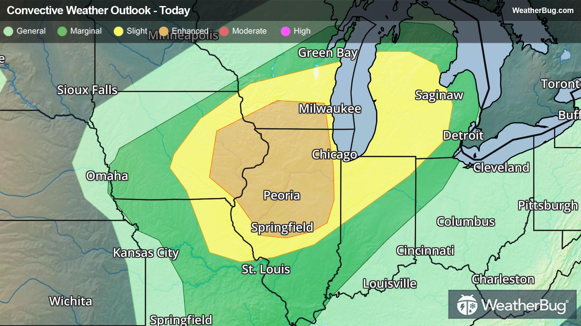
Energy aloft, a low-level jet, and moisture streaming in from the south will all aid in the development of potential tornadoes, high winds, and large hail this afternoon and evening. The Storm Prediction Center currently has a Slight Risk from eastern Missouri and eastern Iowa to central Michigan. There is also an Enhanced Risk across eastern Iowa, southern Wisconsin and northern Illinois. Cities included are Cedar Rapids, Iowa, St. Louis, Peoria, Ill., Chicago, Milwaukee, and Detroit.
Thunderstorms will initially start off as supercells or clusters this afternoon before evolving into organized lines later this evening. Storm should weaken as they cross over Lakes Huron and Erie.
On this storms heels will be another low pressure system on Friday, which could produce similar severe threats across the southern Plains and Lower Midwest. These storms could pose a flooding threat both today and Friday since they could drop 1 to 3 inches of rain over a relatively short period of time.
Make sure to know the difference between a watch and a warning should they be issued. A "watch" means that conditions are favorable for severe weather to occur, and to be on alert for any rapidly changing conditions. A "warning" means that severe weather is imminent, and you should act fast to remain safe.
The best way to remain safe is to stay prepared and informed about your local weather. Have a severe weather kit packed with a battery-operated radio, water, and non-perishable food items. Also, check the WeatherBug app frequently for any updates on today's severe weather. Remember, "When Thunder Roars, Go Indoors!"