Severe Weather Threat Persists Across South-Central High Plains
The severe weather threat continues across the south-central High Plains tonight.
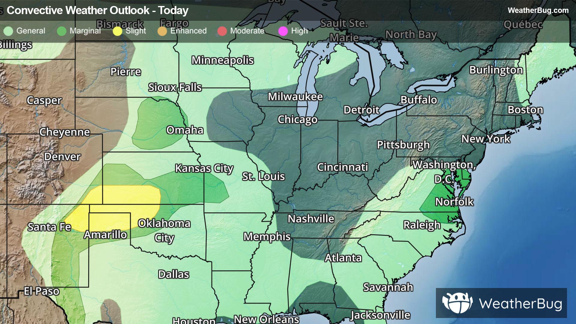
Separately, a Slight Risk has been posted for parts of the southern High Plains. Here, isolated supercells and severe thunderstorm clusters will continue to be possible through tonight. Towns including Guymon, Okla., and Liberal, Kan., could observe severe thunderstorms capable of damaging winds, large hail, and even a tornado or two.
A Severe Thunderstorm Watch is in effect for portions of southwest and south-central Kansas, northwest Oklahoma and the Oklahoma Panhandle, and the northern Texas Panhandle. Cities include Dalhart, Tex., Clayton, N.M., Elkhart and Gage, Okla., and Dodge City, Kan.
Make sure to know the difference between a watch and a warning should they be issued. A "watch" means that conditions are favorable for severe weather to occur, and to be on alert for any rapidly changing conditions. A "warning" means that severe weather is imminent, and you should act fast to remain safe.
The best way to remain safe is to stay prepared and informed about your local weather. Have a severe weather kit packed with a battery-operated radio, water, and non-perishable food items. Also, check the WeatherBug app frequently for any updates on today's severe weather. Remember, "When Thunder Roars, Go Indoors!"