Snow, Ice Target the Eastern U.S.
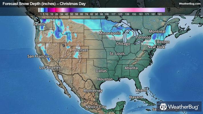
After a relatively tranquil Christmas, a potent low pressure system will bring a wintry mix of snow, sleet, and ice to the eastern U.S. on Friday.
An area of low pressure taking shape today over the northern Plains will quickly race eastward across the Lower Great Lakes tonight and Friday. Near and north of this low pressure system, a wintry mix of snow and ice is expected across the Dakotas and Minnesota today into the Great Lakes.
Winter Weather Advisories are in place across eastern North Dakota, Minnesota, northwestern Wisconsin, and the Upper Peninsula of Michigan.
Moisture will reach the Northeast and Mid-Atlantic states by Friday afternoon, with precipitation lingering into Saturday morning as the low pressure system moves off and away from the coast.
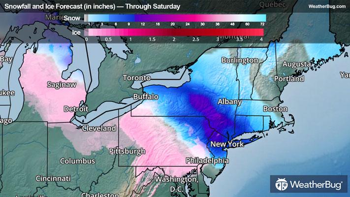
Near and north of this low pressure system, plenty of cold air near the surface will allow for periods of freezing rain and sleet to spread across parts of western New York, Pennsylvania, Maryland, and New Jersey. Not too far to the north, enough cold air will be in place for mostly snow to fall across northern New Jersey into southern New England.
The exact track of this low pressure will determine snow and ice accumulations. However, many areas across southern New York into northeastern Pennsylvania, northern New Jersey, and Connecticut can expect a plowable snow. Here, snow accumulations of 2 to 6 inches are likely, while locally up to 8 inches will be possible.
Across western and central Pennsylvania, a significant icing event will be possible as ice accretion of a quarter to a half inch will be possible. Farther to the south and east, upwards of a tenth of an inch of ice will be possible across southeastern Pennsylvania, Maryland, and northern Virginia.
Winter Storm Watches are in place across parts of western and southern New York, southwestern Connecticut, much of Pennsylvania, and most of New Jersey.
Cities such as Pittsburgh, Washington, Philadelphia, and New York are at threat for the wintry weather Friday into Saturday.
Snow will linger throughout much of the morning across southern New England to near New York City. Farther south, the wintry mix will end around mid-morning in Pennsylvania and New Jersey, while any wintry mix in Maryland and northern Virginia will change to plain rain Friday night and will end prior to daybreak on Saturday.
Be sure to download the WeatherBug app to stay up to date on the latest on this changing weather. It’s never too early to have a supply kit packed in case of inclement weather. A simple kit including a weather radio, water, blankets, batteries, and non-perishable food items will go a long way in the event of a power outage.