
Wednesday's Weather Outlook
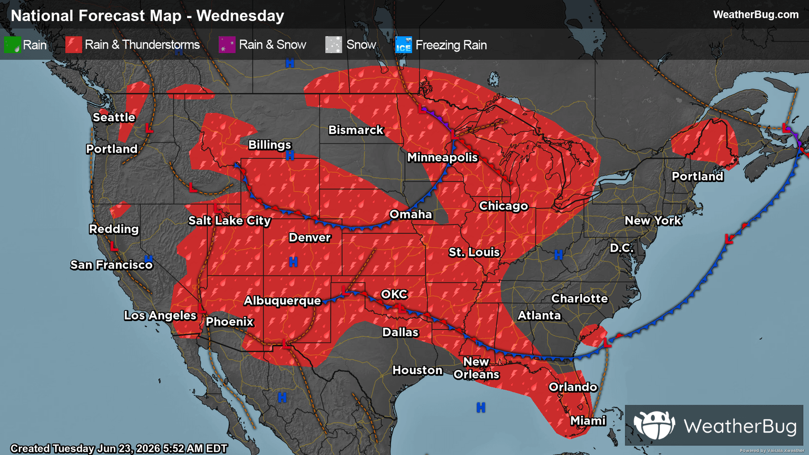
Much of the Central U.S. will be susceptible to showers and thunderstorms on Wednesday as the East trends drier.
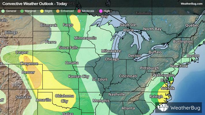
A pair of disturbances, one near the Canada border and one in the central Plains, will produce scattered showers and thunderstorms in the Central U.S. throughout the day. Most storms will be concentrated over the Midwest, the Mississippi Valley, and the central Plains. The best shot at severe weather will be in the central Plains and in the High Plains from Wyoming southward into eastern Colorado and the Texas Panhandle.
More isolated showers and storms will develop across the Rockies in the afternoon and evening as a disorganized system slides across the central Rockies. A few showers and thunderstorms could also pop up along the higher elevations of the West Coast; otherwise, the West will be dry thanks to a ridge of high pressure overhead.
In the East, a storm system moving into Atlantic Canada will provide Maine with some lingering showers and embedded storms in the morning and afternoon. High pressure provides most of the Northeast, Mid-Atlantic, and Southeast with dry weather. Scattered thunderstorms are expected across central and southern Florida.
Much of the Central U.S., Great Lakes, and interior portions of the Northeast and Mid-Atlantic will see temperatures running cooler than normal for this time of year. Warmer-than-normal temperatures will be prevalent across Florida and most of the West.
Highs will be in the mid-60s to 70s from the northern Plains to the Great Lakes and New England. Mid-70s to mid-80s are expected from the Mid-Atlantic to the southern Midwest, central Plains, and higher elevations of the Northwest. Much of the Southeast, Gulf Coast, West Coast, and Intermountain West has highs in the 80s and 90s. There will be some 100s stretching from the Desert Southwest to western Texas.