
Weekend Weather Outlook
Summer will officially arrive this weekend, and for most of the country, the weather will feel like it.
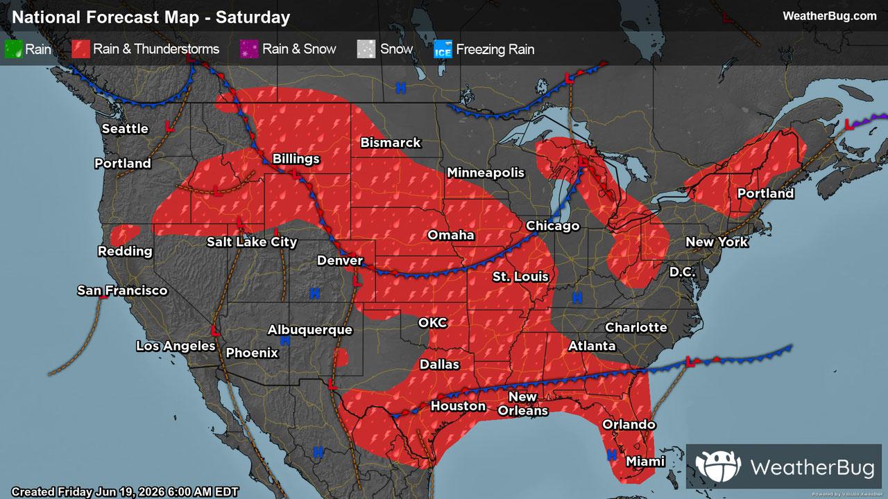
Saturday
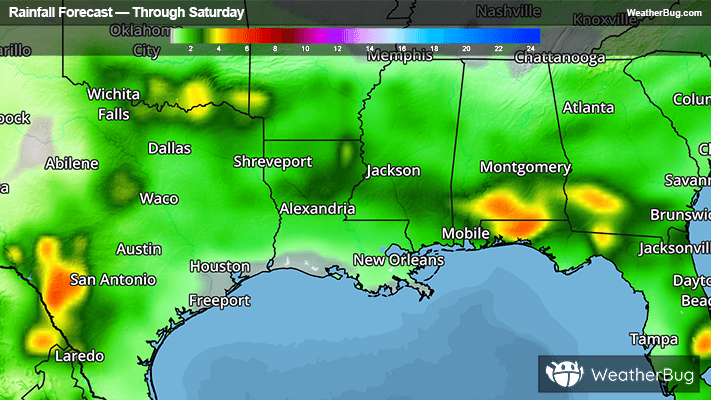
The biggest trouble spot on Saturday will be along the central Gulf Coast where a cold front will stubbornly remain in place. Occasional showers and thunderstorms can be expected from eastern Texas to northern Florida. In between storms, expect high humidity with breaks of sunshine.
Another disturbance moving through the Upper Midwest will bring a few showers and thunderstorms to South Dakota and western Nebraska. While widespread severe thunderstorms aren’t expected, a few big hail-makers are still possible.
Outside of a few showers across the Great Lakes and northern New England, the remainder of the country will enjoy a sunny Saturday.
The coolest high temperatures will be in the upper 60s to lower 70s across northern New England, northern Minnesota and the Michigan Upper Peninsula, while much of the West Coast, Dakotas, and Great Lakes will find the mercury reaching the upper 70s and lower 80s. From interior California to the Rockies, and from the Front Range to the Eastern Seaboard, summer-like middle 80s can be expected. The warmest readings on Saturday will be found in the Desert Southwest, Texas and Florida, where 90s and even a few 100s will be common.
Sunday
Summertime will officially be here when the kids wake up Dad on Sunday morning, with the solstice occurring at 4:24 a.m. EDT. Father’s Day will feature plenty of summertime thunderstorms along a storm system moving across the Plains into the Mississippi Valley. These storms, which could be locally severe, will impact areas from Illinois to Alabama, as well as most of the Dakotas.
Meanwhile, dads in Florida will have to contend with typical daily thunderstorms, especially along the southern half of the peninsula. These brief downpours could leave outdoor Father’s Day plans a little drenched.
Likewise, thunderstorms could make a hike or round of golf difficult in northern New England. Otherwise, the rest of the Eastern Seaboard, the Great Lakes, Southwest and West Coast will see perfect weather for the first day of summer.
Cool 60s will be found across the Dakotas, with 70s and lower 80s occupying the northern tier from Montana to New England. Upper 80s and lower 90s will surge northward along the West and East Coasts, as well as in the central Plains and Tennessee Valley. Highs in the middle 90s will return to the Carolinas and Florida on Sunday, while dads from Arizona to western Texas should seek air conditioning with highs near or a bit above the triple-digit mark.