Severe Weather Outbreak Targets the Midwest
An outbreak of severe weather is expected across the Midwest today, including the risk for intense tornadoes.
Read MoreAn outbreak of severe weather is expected across the Midwest today, including the risk for intense tornadoes.
Read More
A disorganized Potential Tropical Cyclone One may become the Atlantic season's first named storm today.
Read More
Active weather persists across parts of the East, South, and Central U.S. today, while much of the West stays dry. However, some areas may see a more organized severe weather threat compared to recent days.
Read More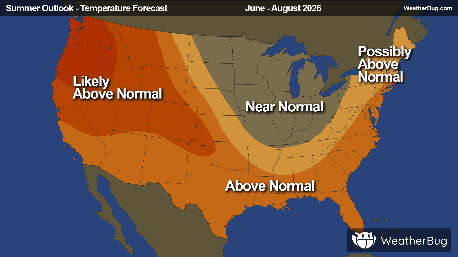
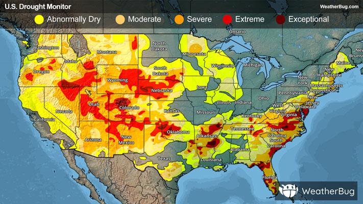
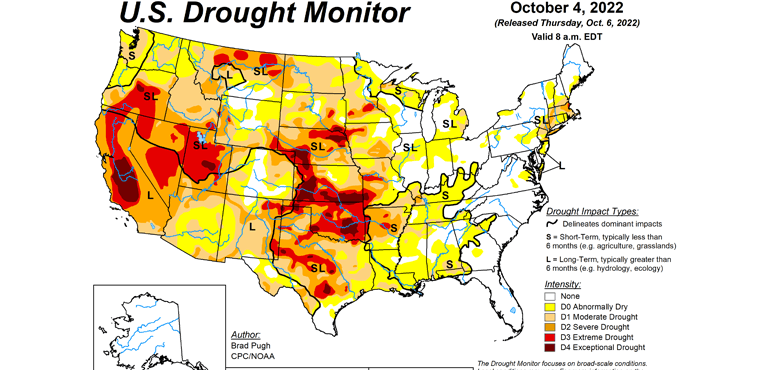
As this year’s meteorological summer swings in, many folks wonder what might be in store.
Read More