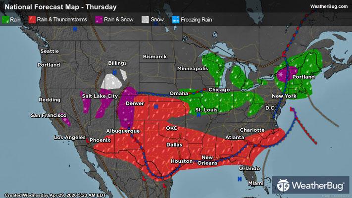
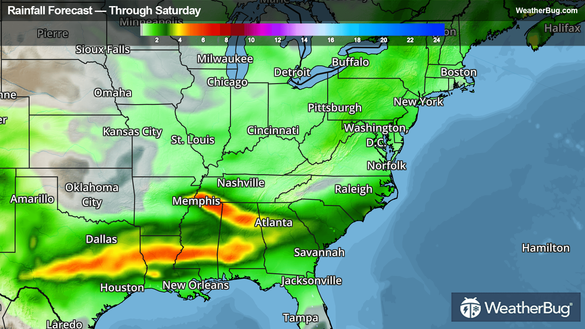
Andover, VT Weather

As of

Weather Station:Hartness State Arpt North Springfield

Open weather station selector modal

35degrees Fahrenheit

Feels like:31°F

Hi: 40Lo: 30

70% Chance of Heavy Snow

Live Weather Radar

Andover, VT weather radar map

Current Weather Details

Windchill
31°
Daily Rain
0.03"
Dew point
30°
Monthly Rain
1.43"
Humidity
82%
Avg. Wind
SE 5 mph
Pressure
29.76" →
Wind Gust
5 mph
Sunrise
6:51 AM
Moon
Waxing Crescent
Sunset
7:05 PM
UV Index
1 (Low)

Weather Forecast

  • Today

    Hi

    Freezing rain. Snow and sleet through late morning then rain this afternoon. Snow and sleet accumulation up to 1 inch. Additional ice accumulation of up to a tenth of an inch. Highs in the upper 30s. Southeast winds 10 to 15 mph. Chance of precipitation near 100 percent.

  • Tonight

    Lo

    Cloudy. A chance of rain or drizzle or a slight chance of snow until midnight then a slight chance of freezing drizzle after midnight. Ice accumulation around a trace. Lows in the mid 20s. Light and variable winds. Chance of precipitation 50 percent.

Andover, VT 10-day weather forecast

AIR QUALITY

23 | Fair

Top Triggers:pm25
Air quality data provided by Ambee
View Today's Air Quality details for Andover, VT

POLLEN COUNT & ALLERGY FORECAST

0.5 Low

Predominant Pollen:Cedar/Juniper, Poplar/Aspen/Cottonwood and Elm
View the Pollen forecast details

LIGHTNING MAP

Closest strike in the last 30 minutes:3169.0 miles

No Lightning Nearby

Real-time lightning alerts & live Map