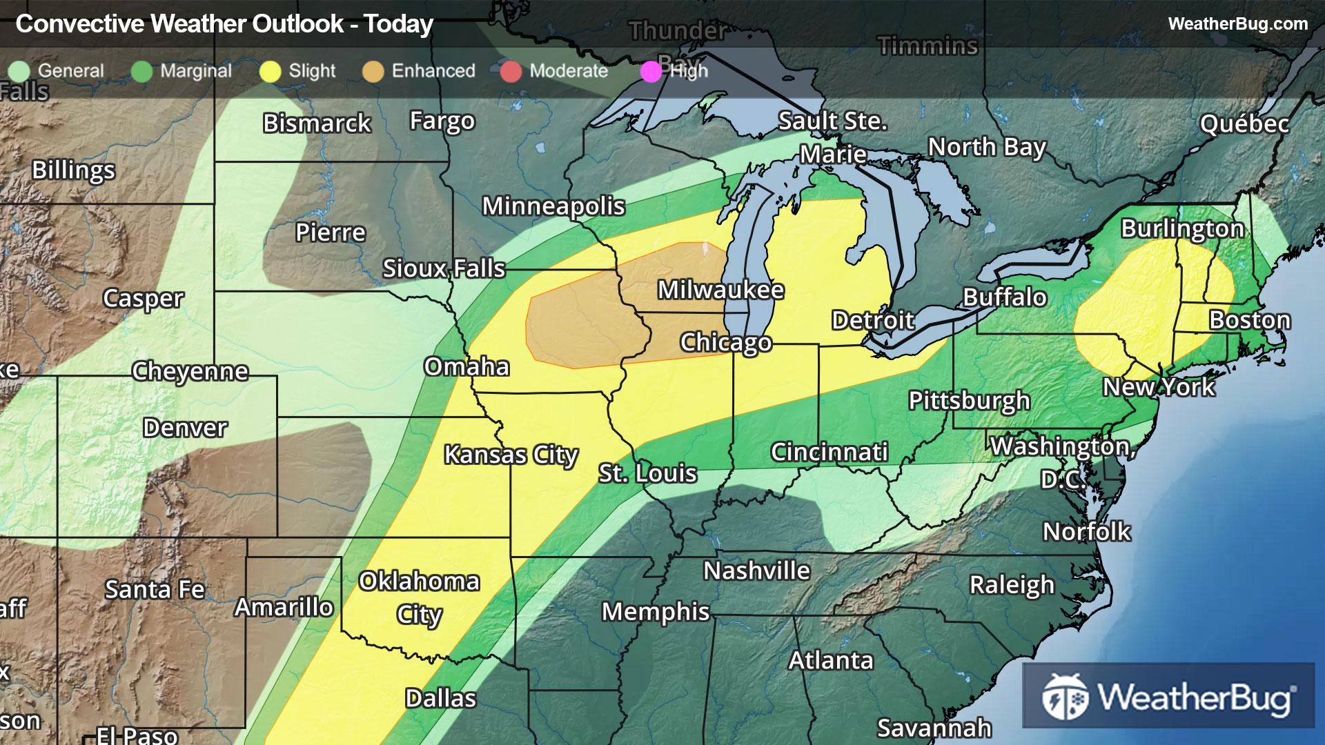
Severe Storms Take Aim at the Northeast, Midwest, Plains
Summer-like warmth and humidity spreading northward will help fuel another round of severe thunderstorms today.
Read More
Weather Station:Buffalo Niagara Intl Arpt
59degrees Fahrenheit
Feels like:59°F
Hi: 68Lo: 58
70% Chance of Light Rain
Hi68°F
Mostly cloudy. Showers with a chance of thunderstorms this morning. Breezy warm with highs ranging from the mid 60s along the lake erie shore to the lower 70s inland. South winds 5 to 10 mph becoming southwest and increasing to 15 to 25 mph with gusts up to 40 mph. Chance of rain 80 percent.
Lo58°F
Mostly cloudy. Showers with a chance of thunderstorms overnight. Mild with lows ranging from the mid 50s along the lake erie shore to the upper 50s inland. Southwest winds 10 to 15 mph with gusts up to 30 mph in the evening becoming south. Chance of rain 80 percent.
30 | Fair
8.3 Medium-High
Closest strike in the last 30 minutes:7.4 miles
Stay Alert!


