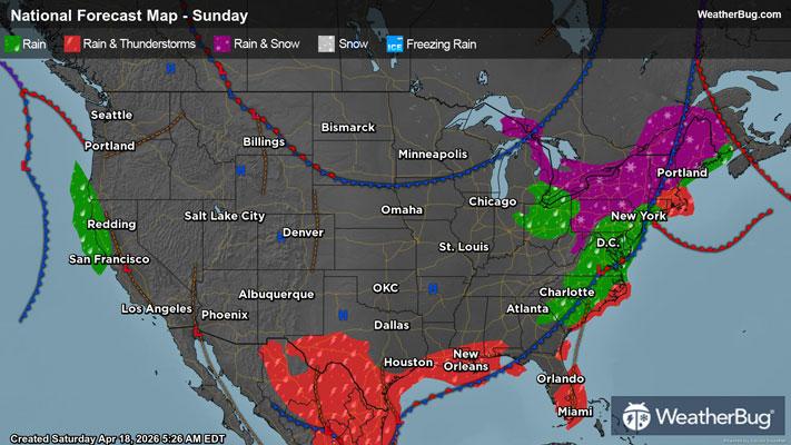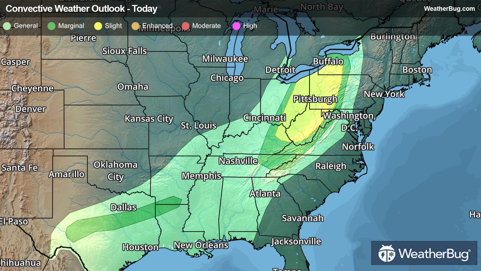
Severe Thunderstorms Shift to Ohio Valley, Central Texas
The last round of severe thunderstorms in an active pattern across the Central U.S. will target the Upper Ohio Valley and central Texas today.
Read More
Weather Station:Miami University Arpt Oxford
41degrees Fahrenheit
Feels like:35°F
Hi: 46Lo: 38
Mostly Clear
Lo38°F
Partly cloudy with a chance of rain. Chance of precipitation 35%. Low temperature around 38F. Dew point will be around 35F with an average humidity of 68%. Winds will be 9 mph from the NW.
Hi56°F
Areas of frost this morning. Mostly sunny. Cooler with highs in the upper 50s. West winds 10 to 15 mph with gusts up to 30 mph.

24 | Fair
3.4 Low-Medium
Closest strike in the last 30 minutes:902.5 miles
No Lightning Nearby