A very strong Arctic blast is headed to the eastern two-thirds of the nation through the upcoming work week, plunging temperatures to levels not seen in as much as a decade.
A potent cold front will advance across the Eastern U.S. today into early Monday, allowing a large surge of bitter cold, Arctic air to filter into the Lower 48. The coldest temperatures in the U.S. will be found across the nation’s midsection through Tuesday, before shifting into the East for the second half of the work week. Over the next week, temperatures will be as much as 30 to 40 degrees below the normal for this time of year!
High temperatures will remain below zero for the far northern Plains and Upper Mississippi Valley. High temperatures today will range from a few degrees below zero to -15 degrees. Single digits and teens will be in the forecast for most of the Rockies into the Midwest and Great Lakes, while 20s and 30s are likely for the south-central U.S. The mercury could climb into the 40s for the Gulf Coast.
Widespread Winter Weather Advisories are in effect over the next few days for most areas along and east of the Rockies. Scattered Extreme Cold Warnings have been posted across the north-central U.S. from Montana, eastern Idaho and Wyoming into Nebraska, Minnesota, northern Wisconsin and Michigan’s Upper Peninsula, as well as parts of Georgia, Alabama and Mississippi. Extreme Cold Watches also stretch across western Colorado, parts of New Mexico, western Kansas and the Texas and Oklahoma panhandles.
Similar temperatures will be found in the central U.S. on Monday, though the freezing temperatures will spread into the East. Highs will be in the single digits for the Great Lakes, Ohio Valley and interior Northeast, with a few spots staying below zero. Teens and 20s are expected for the Tennessee Valley and Mid-Atlantic. Wind chills in the single digits will be common throughout the day on Monday, including for cities such as Washington, Philadelphia, New York, and Boston.
While temperatures gradually warm up in the Central U.S. Tuesday through Friday, frigid air remains in place across the Eastern Seaboard. Widespread Cold Weather Advisories have been issued for most of the eastern half of the U.S.
The cold blast has already changed plans for at least one event: Monday’s Presidential Inauguration, scheduled to take place at Noon on the U.S. Capitol’s Western Portico, has been moved inside to the Capitol Rotunda for the first time in 40 years.
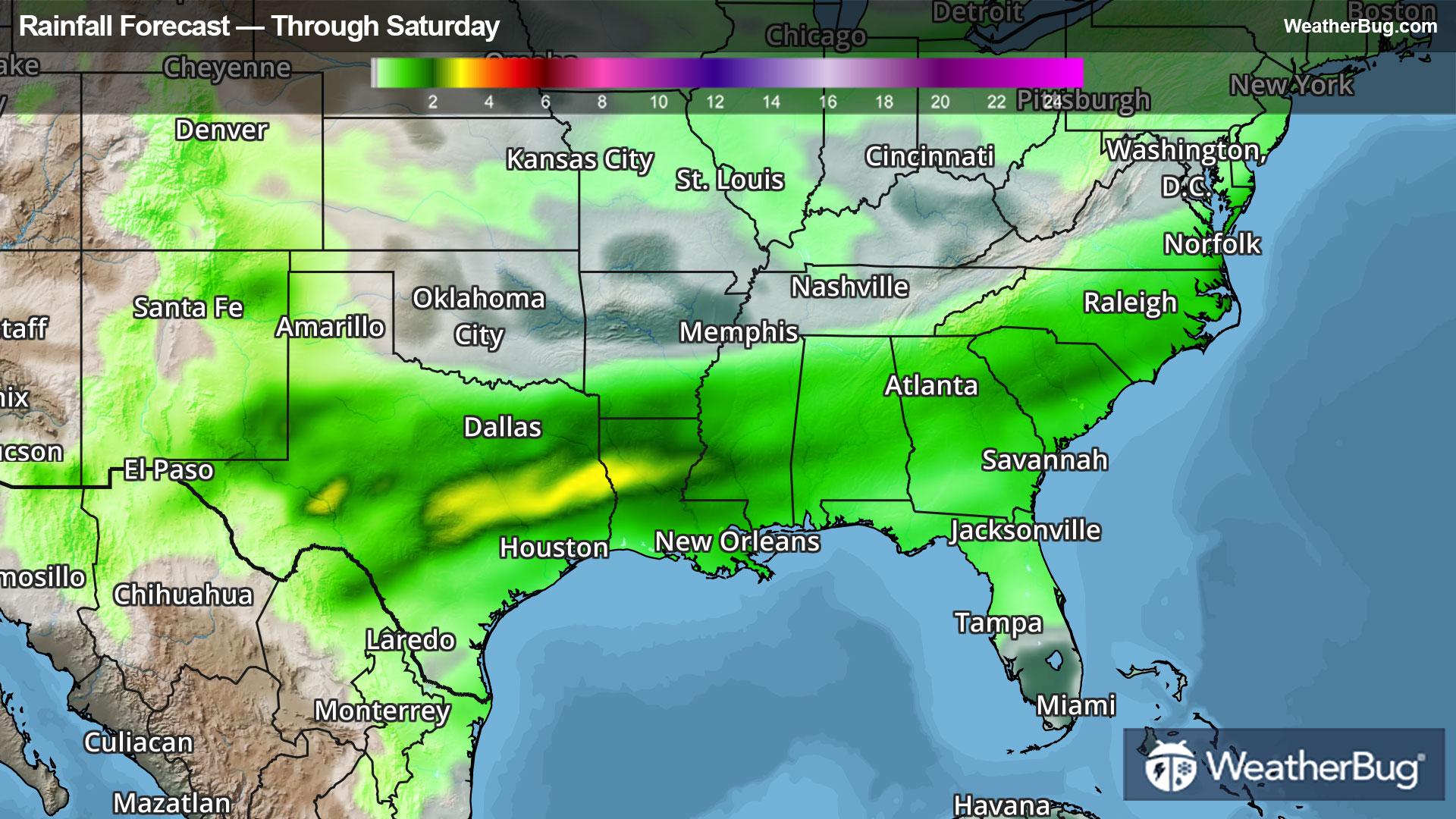
As if that weren’t enough, an area of low pressure is poised to form across Texas early next week, then march northeastward along the Gulf Coast. Feeding off the bitterly cold air in place, snow and freezing rain is likely early next week in Houston, with significant ice accretions possible as far south as the I-10 corridor in Florida. Winter Storm Watches have been issued from Texas to Mississippi, including metro Houston and metro New Orleans.
Cold temperatures and wind chills to the levels mentioned above can lead to frostbite in a matter of minutes, particularly on exposed skin. Try to limit outdoor activity during this cold snap, check on the elderly and pets, and others who might not have access to warming centers.