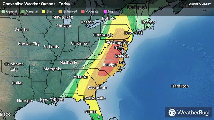
Dangerous Storms Take Aim At The Eastern U.S.
After more than 400 reports of severe weather on Sunday, a greater risk of dangerous thunderstorms exists today.
Read More
Weather Station:WeatherBug
14degrees Fahrenheit
Feels like:-2°F
Hi: 18Lo: 4
50% Chance Frozen Mix
Hi15°F
Windy. Colder. Snow in the morning then a chance of light snow in the afternoon. Significant blowing and drifting snow. Snow may be heavy at times in the morning. Snow accumulation of 2 to 7 inches. Highs in the middle teens. North wind 20 to 30 mph with gusts to around 45 mph. Chance of snow near 100 percent. Wind chills to 10 below zero.
Lo3°F
Mostly cloudy with a chance of light snow. Lows zero to 5 above. North wind 10 to 15 mph. Chance of snow 40 percent.

21 | Fair
0.5 Low
Closest strike in the last 30 minutes:774.9 miles
No Lightning Nearby


