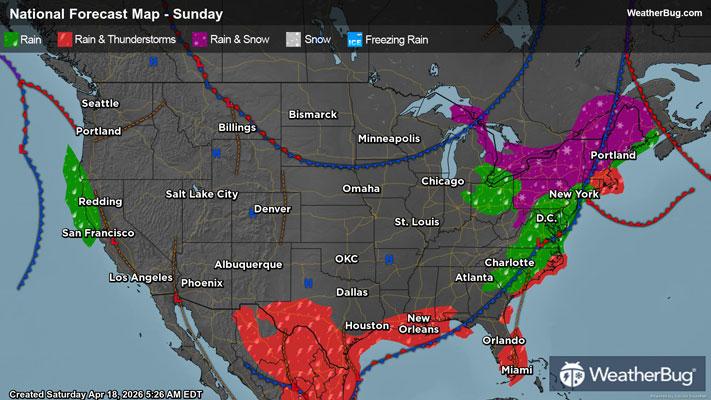
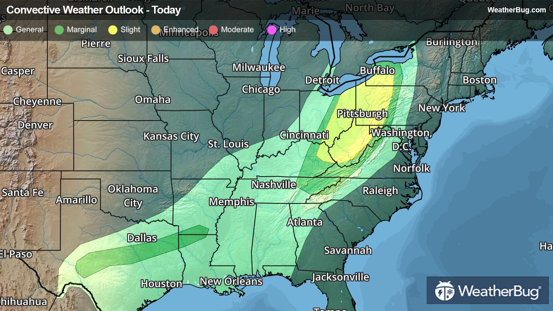
Cottonwood Falls, KS Weather

As of

Weather Station:WeatherBug

Open weather station selector modal

--degrees Fahrenheit

Feels like:--

Hi: --Lo: --

Live Weather Radar

Cottonwood Falls, KS weather radar map

Current Weather Details

Windchill
--
Daily Rain
--
Dew point
--
Monthly Rain
--
Humidity
--
Avg. Wind
--
Pressure
--
Wind Gust
--
Sunrise
7:06 AM
Moon
First Quarter
Sunset
6:12 PM
UV Index
4 (Moderate)

Weather Forecast

  • Tonight

    Lo

    Partly cloudy. Not as cold with lows around 30. Temperature rising into the mid 30s after midnight. Southeast winds 10 to 15 mph becoming south 15 to 20 mph with gusts up to 30 mph after midnight.

  • Tomorrow

    Hi

    Partly sunny. Much warmer with highs in the mid 60s. Southwest winds 15 to 20 mph with gusts up to 30 mph.

Cottonwood Falls, KS 10-day weather forecast

AIR QUALITY

21 | Fair

Top Triggers:pm25
Air quality data provided by Ambee
View Today's Air Quality details for Cottonwood Falls, KS

POLLEN COUNT & ALLERGY FORECAST

0.4 Low

Predominant Pollen:Cedar/Juniper and Elm
View the Pollen forecast details

LIGHTNING MAP

Closest strike in the last 30 minutes:2164.9 miles

No Lightning Nearby

Real-time lightning alerts & live Map