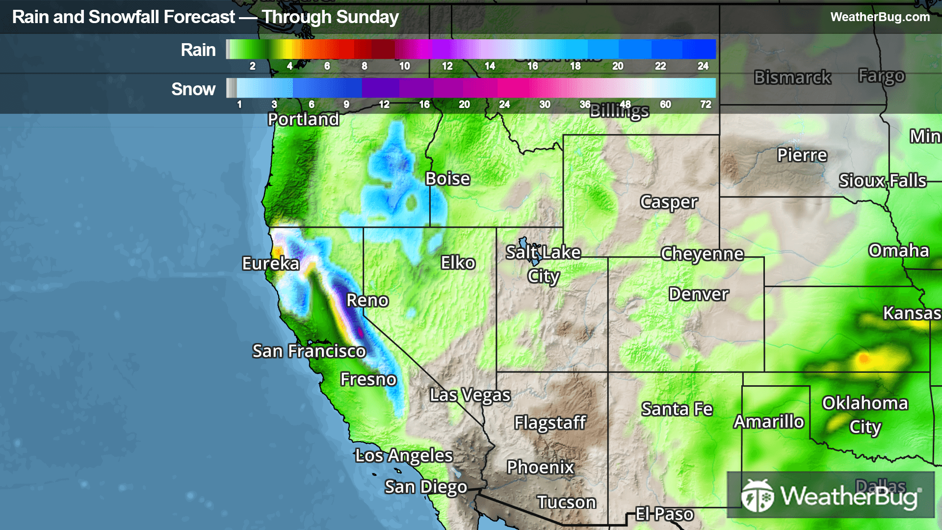
Goetzville, MI Weather

As of

Weather Station:DRUMMOND IS

Open weather station selector modal

6degrees Fahrenheit

Feels like:6°F

Hi: 22Lo: 6

Mostly Cloudy

Live Weather Radar

Goetzville, MI weather radar map

Current Weather Details

Windchill
--
Daily Rain
--
Dew point
--
Monthly Rain
--
Humidity
--
Avg. Wind
--
Pressure
--
Wind Gust
--
Sunrise
7:59 AM
Moon
Full
Sunset
5:41 PM
UV Index
1 (Low)

Weather Forecast

  • Tonight

    Lo

    Mostly cloudy. A 20 percent chance of snow showers after midnight. Lows around 12. South winds up to 10 mph.

  • Tomorrow

    Hi

    Mostly cloudy. Light snow showers likely early then chance of snow showers in the afternoon. Total daytime snow accumulation around 1 inch. Highs in the upper 20s. Southwest winds 5 to 10 mph. Chance of snow 70 percent.

Goetzville, MI 10-day weather forecast

AIR QUALITY

25 | Fair

Top Triggers:pm25
Air quality data provided by Ambee
View Today's Air Quality details for Goetzville, MI

POLLEN COUNT & ALLERGY FORECAST

0.1 Low

Predominant Pollen:None
View the Pollen forecast details

LIGHTNING MAP

Closest strike in the last 30 minutes:1310.7 miles

No Lightning Nearby

Real-time lightning alerts & live Map