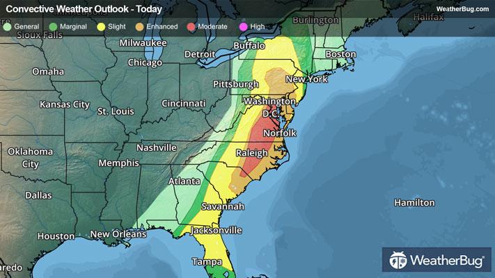
Dangerous Storms Take Aim At The Eastern U.S.
After more than 400 reports of severe weather on Sunday, a greater risk of dangerous thunderstorms exists today.
Read More
Weather Station:Dubuque Regional Airport
17degrees Fahrenheit
Feels like:-1°F
Hi: 23Lo: 7
Windy
Hi23°F
Mostly cloudy. A chance of snow early then numerous flurries this afternoon. Patchy blowing snow. Additional snow accumulation little or no. Brisk colder. Near steady temperature around 19. Northwest winds 15 to 25 mph with gusts up to 35 mph. Chance of snow 40 percent.
Lo7°F
Mostly cloudy with numerous flurries in the evening then partly cloudy after midnight. Much colder with lows around 1 below. Northwest winds 10 to 20 mph. Gusts up to 30 mph in the evening. Wind chill values as low as 15 below after midnight.

20 | Fair
0.6 Low
Closest strike in the last 30 minutes:833.3 miles
No Lightning Nearby


