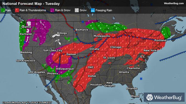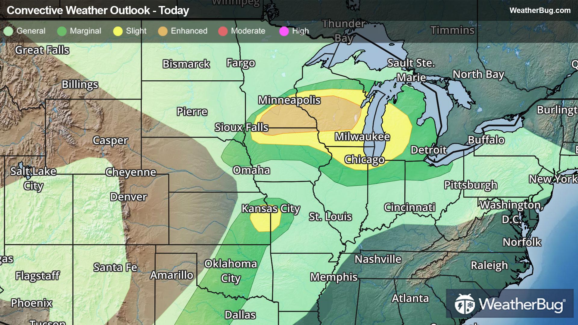
Parade of Storms Hits The Plains, Midwest
Severe thunderstorms are moving across the central U.S. this evening, bringing strong winds, hail and tornadoes from Minnesota to Missouri.
Read More
Weather Station:EVELETH MUNI
43degrees Fahrenheit
Feels like:40°F
Hi: 54Lo: 36
Mostly Cloudy
Lo37°F
Mostly cloudy with a 20 percent chance of showers. Patchy fog. Near steady temperature in the lower 40s. East winds around 5 mph.
Hi44°F
Mostly cloudy. Patchy fog in the morning. A chance of rain mainly in the morning. Highs around 50. East winds around 5 mph. Chance of rain 50 percent.

28 | Fair
6.8 Medium
Closest strike in the last 30 minutes:255.2 miles
No Lightning Nearby