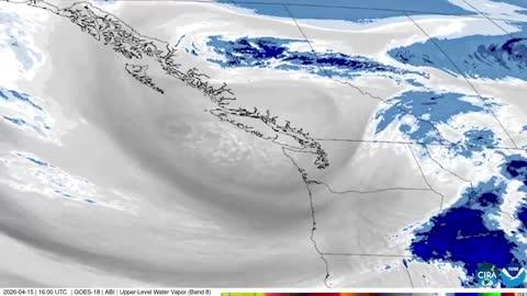
GroundTruthWeatherBug for Advertisers
  • Sign In
  • Press
  • Education
  • Feedback
  • Careers
  • Settings
  • Forecasts
  • Maps
  • Alerts
  • Life
  • News & Videos
  • Cameras
  • Air Quality
  • Hurricane
0
NowHourly10 Day
  • Today's Weather - Johnson City, TX

    Jul 28, 2025 3:55 AM
    WeatherBug
    73°
    Weather forecast icon
    Feels like 73°
    Hi --
    Lo 73°F
    Hazy
  • WEATHER DETAILSJohnson City, TX
    • Windchill--
      Daily Rain--
    • Dew Point--
      Monthly Rain--
    • Humidity--
      Avg. Wind--
    • Pressure--
      Wind Gust--
    • Sunrise6:49 AM
      MoonWaxing Crescent
    • Sunset8:30 PM
      UV Index12 (Extreme)
  • WEATHER FORECASTJohnson City, TX
    TonightLo 74°F
    Weather forecast icon
    Partly cloudy with a slight chance of rain. Chance of precipitation 25%. Low temperature around 74F. Dew point will be around 72F with an average humidity of 79%. Winds will be 6 mph from the S.
    TomorrowHi 93°F
    Partly cloudy this morning then clearing. Highs in the lower 90s. South winds around 5 mph.
  • Featured Videos
  • Air QualityJohnson City, TX
    24 | Fair
    Top Triggers: PM2.5
    Air quality data provided by Ambee
  • POLLEN COUNT & ALLERGY FORECASTJohnson City, TX
    ic_pollen_web
    6.9 Medium
    Predominant Pollen:
    Grass
  • Lightning MapJohnson City, TX
    Closest strike in the last 30 minutes: 739.7 miles away
    No Lightning Nearby
    • TOP STORIES
      Severe Weather Zaps North-Central U.S.
      The end of July will go out with a bang as multiple rounds of severe weather target the northern Plains and Upper Mississippi Valley.

      An upper-level weather system and associated cold front will drop south into the north-central U.S. today. Very warm, humid air will be in place ahead of the front, while cooler and drier air attempts to stream in behind it. This collision of air masses will cause thunderstorms to bubble up in the northern Plains and Upper Mississippi Valley this evening. As they move south and east, these storms will likely strengthen, quickly turning strong to severe.

      The government’s Storm Prediction Center has issued an Enhanced Risk for severe weather today across southern to eastern Minnesota and far eastern South Dakota, which includes Minneapolis. There is also a Slight Risk for severe weather today. This covers most of Minnesota into northern Wisconsin and Michigan’s Upper Peninsula, including Duluth, Minn. The main concern within thunderstorms here would be damaging winds exceeding 60 mph, large hail and torrential downpours. However, an isolated tornado or two cannot be ruled out.

      A Severe Thunderstorm Watch is in effect for portions of central and southern Minnesota and eastern South Dakota. Another Severe Thunderstorm Watch is in effect for portions of northern Minnesota, far northwest Wisconsin and Lake Superior. 

      However, anyone in the northern Plains and Upper Mississippi Valley should keep a close eye on rapidly changing weather. Gusty winds and small hail could still be a possibility for places like Glasgow, Mont., Minot and Grand Forks, N.D., Des Moines, Iowa, La Crosse and Green Bay, Wis., and Marquette, Mich.

      The same cold front will inch south and east across the north-central U.S. on Monday. This will keep the threat of severe weather in the northern Plains and Upper Mississippi Valley.

      Make sure to know the difference between a watch and a warning should they become issued. A watch means that conditions are favorable for severe weather to occur and to be on alert for any rapidly changing conditions. A warning means that severe weather is imminent, and you should act fast to remain safe.

      The best way to remain safe is to stay prepared and informed about your local weather. Have a severe weather kit packed with a battery-operated radio, water and non-perishable food items should you be without power for long periods of time. Also, check the WeatherBug app frequently for any updates on today’s severe weather. Remember, “When Thunder Roars, Go Indoors!”
      Read More
      Major Heatwave Set to Bake Eastern Two-Thirds of U.S.
      Read More
      Today's Weather Outlook
      Read More
      Heat-Related Alerts: Sizzling Differences
      Read More
      How Do Wildfires Start and Spread?
      Read More
      How to Stay Cool When There's No A.C.
      Read More
      MORE NEWS
      • TODAY'S NATIONAL OUTLOOK
      • Hurricane TrackerJohnson City, TX
        No Active Hurricanes or Warnings Issued
      • Allergy ForecastJohnson City, TX
        • Cold & FluJohnson City, TX
        • Snow & Ski ForecastJohnson City, TX
    • Fire Updates
      Johnson City, TX
      Local Fire Map
    • Traffic Cameras
      Johnson City, TX
    • Weather Cameras
      Johnson City, TX
      No Weather Cams available in this region
    • Outdoor Sports GuideJohnson City, TX
Always Have Access to WeatherBug at Your Fingertips, It's Free.
Connect With Us
© GroundTruth, 2025. WeatherBug is a brand of GroundTruth. All Rights Reserved. Terms | Privacy | Partners | Ad Choices | Sitemap | USA | FAQ | WeatherBug for Advertisers
  • North America
  • South America
  • Africa
  • Europe
  • Asia
  • Australia