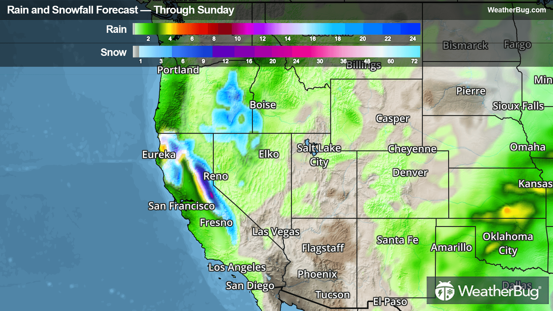
Kieffer, WV Weather

As of

Weather Station:Greenbrier Valley Arpt 2300 ft elev

Open weather station selector modal

21degrees Fahrenheit

Feels like:10°F

Hi: 21Lo: 5

30% Chance of Snow

Live Weather Radar

Kieffer, WV weather radar map

Current Weather Details

Windchill
--
Daily Rain
--
Dew point
--
Monthly Rain
--
Humidity
--
Avg. Wind
--
Pressure
--
Wind Gust
--
Sunrise
7:26 AM
Moon
Full
Sunset
5:45 PM
UV Index
2 (Low)

Weather Forecast

  • Today

    Hi

    Partly sunny and cold. Near steady temperature around 10 above. Northwest winds 15 to 20 mph with gusts up to 35 mph. Wind chill values as low as 12 below.

  • Tonight

    Lo

    Mostly cloudy. Cold with lows around 1 above. Northwest winds 10 to 15 mph with gusts up to 30 mph. Wind chill values as low as 13 below.

Kieffer, WV 10-day weather forecast

AIR QUALITY

22 | Fair

Top Triggers:pm25
Air quality data provided by Ambee
View Today's Air Quality details for Kieffer, WV

POLLEN COUNT & ALLERGY FORECAST

0.3 Low

Predominant Pollen:Mixed Trace
View the Pollen forecast details

LIGHTNING MAP

Closest strike in the last 30 minutes:1115.1 miles

No Lightning Nearby

Real-time lightning alerts & live Map