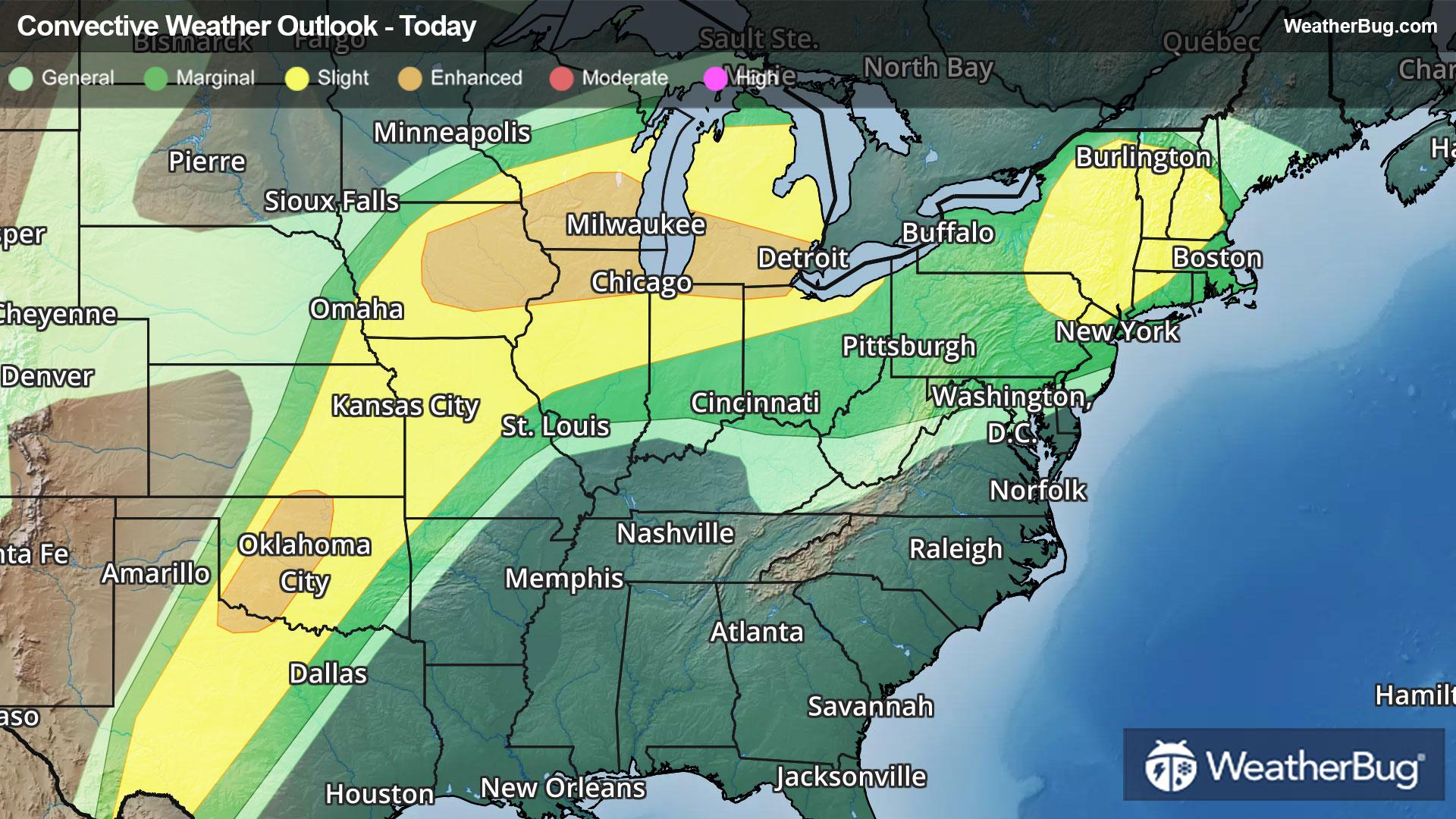
Severe Storms Take Aim at the Northeast, Midwest, Plains
Summer-like warmth and humidity spreading northward will help fuel another round of severe thunderstorms today.
Read More
Weather Station:Calcium Primary School
60degrees Fahrenheit
Feels like:60°F
Hi: 60Lo: 49
70% Chance of Rain
Hi59°F
Patchy fog through early afternoon. Showers late this morning then showers with a chance of thunderstorms this afternoon. Warm with highs ranging from the lower 60s along the lake ontario shore to the upper 60s inland. Southeast winds 10 mph or less becoming southwest 10 to 15 mph. Chance of rain near 100 percent.
Lo49°F
Mostly cloudy. A chance of showers and thunderstorms in the evening. Mild with lows ranging from the upper 40s along the lake ontario shore to the lower 50s across the tug hill. West winds 10 to 15 mph becoming light. Chance of rain 50 percent.

17 | Excellent
8 Medium-High
Closest strike in the last 30 minutes:2.8 miles
Stay Alert!


