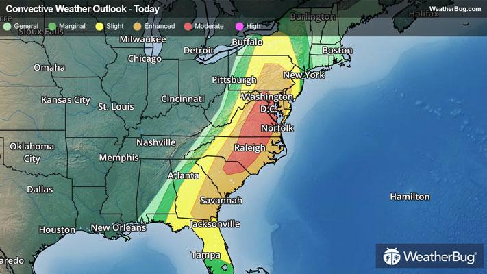
Dangerous Storms Take Aim At The Eastern U.S.
After more than 400 reports of severe weather on Sunday, a greater risk of dangerous thunderstorms exists today.
Read More
Weather Station:Muskego High School
21degrees Fahrenheit
Feels like:9°F
Hi: 22Lo: 5
Heavy Snow
Hi22°F
Colder windy. Snow until late afternoon then slight chance of light snow late in the afternoon. Areas of blowing snow through the day. Snow accumulation of 2 to 3 inches. Total snow accumulation 3 to 8 inches. Near steady temperature in the lower 20s. Northwest winds 20 to 30 mph with gusts to around 45 mph. Chance of snow near 100 percent.
Lo5°F
Colder. Mostly cloudy through around midnight then becoming partly cloudy. Patchy blowing snow in the evening. Lows around 3. Northwest winds 10 to 20 mph.

24 | Fair
0.6 Low
Closest strike in the last 30 minutes:611.1 miles
No Lightning Nearby


