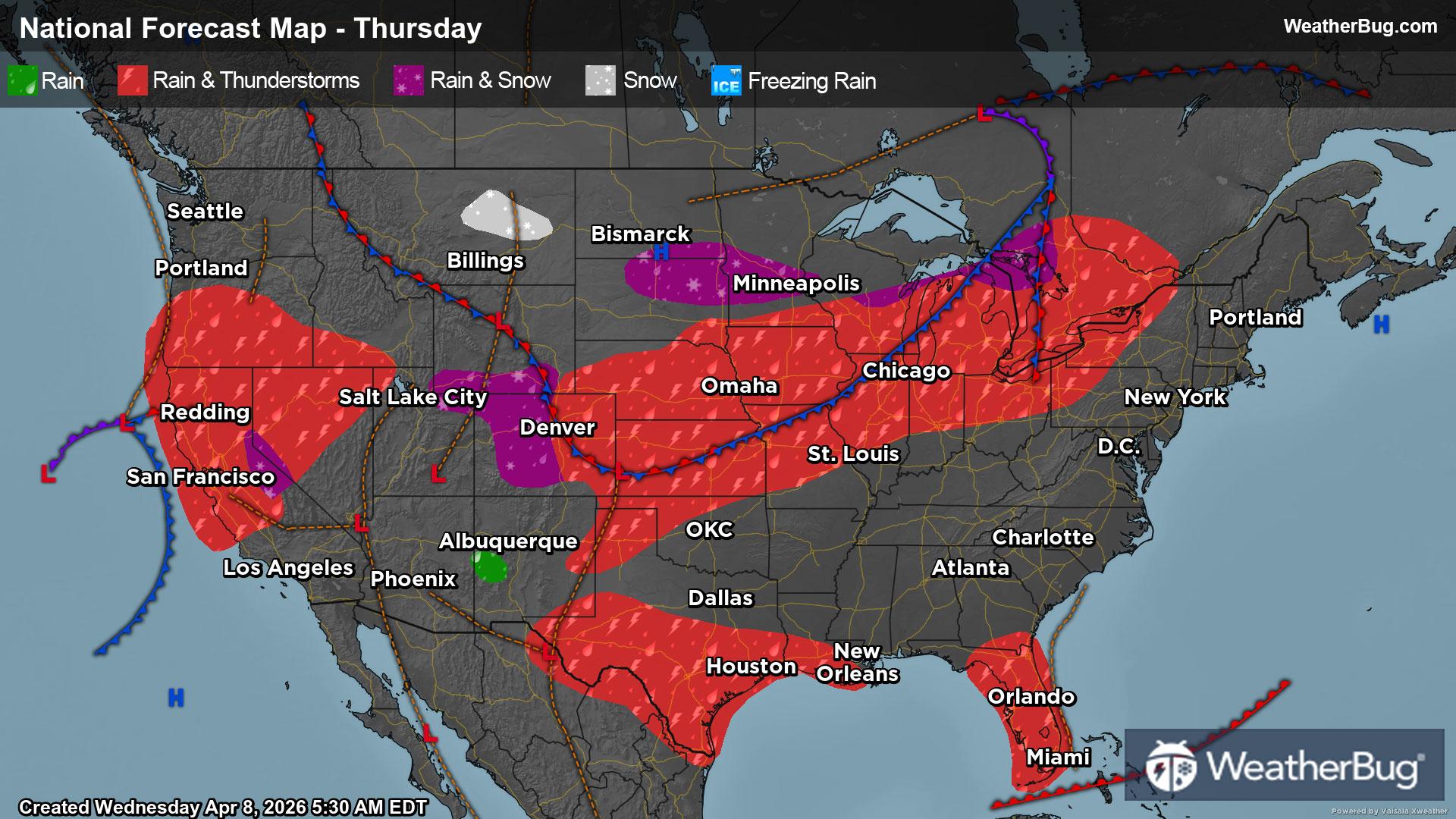
Thursday's Weather Outlook
Thunderstorms will light up the central Plains while the Mountain West sees much-needed wet weather.
Read More
Weather Station:Turtle Creek
71degrees Fahrenheit
Feels like:71°F
Hi: 71Lo: 41
Windy
Hi73°F
Mostly sunny with a 20 percent chance of showers. Breezy and much warmer with highs in the lower 70s. West winds 15 to 25 mph with gusts up to 40 mph.
Lo41°F
Mostly cloudy with a slight chance of showers in the evening then partly cloudy after midnight. Lows around 40. North winds 10 to 15 mph with gusts up to 25 mph diminishing to around 5 mph after midnight. Chance of rain 20 percent.

26 | Fair
10.2 High
Closest strike in the last 30 minutes:1304.9 miles
No Lightning Nearby


