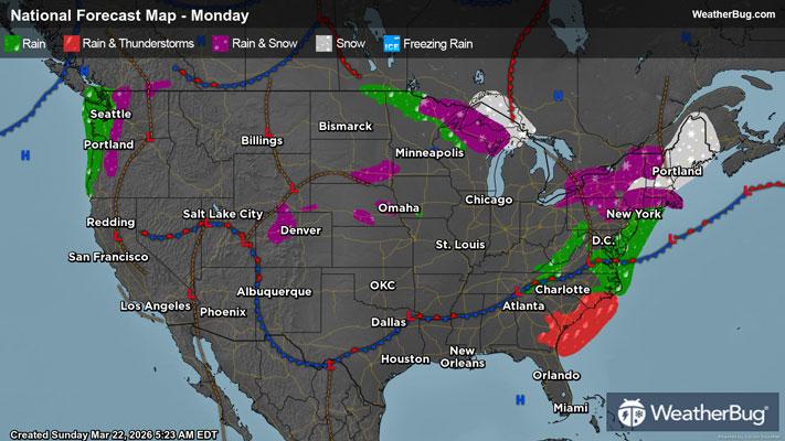
Dangerous Spring Storms Take Aim at Ohio Valley, Mid-Atlantic
Spring is here and Mother Nature is set to bring dangerous thunderstorms to parts of the Great Lakes, Ohio Valley and Mid-Atlantic.
Read More
Weather Station:Hartness State Arpt North Springfield
39degrees Fahrenheit
Feels like:37°F
Hi: 39Lo: 29
80% Chance of Light Rain
Hi39°F
Mostly cloudy with likely rain-snow mix. Chance of precipitation 90%. High temperature around 39F. Dew point will be around 31F with an average humidity of 90%. Winds will be 7 mph from the SE.
Lo29°F
Cloudy. A chance of rain or freezing drizzle or sleet until midnight then a chance of freezing drizzle after midnight. Ice accumulation around a trace. Lows in the upper 20s. Light and variable winds. Chance of precipitation 50 percent.

23 | Fair
0.5 Low
Closest strike in the last 30 minutes:306.5 miles
No Lightning Nearby