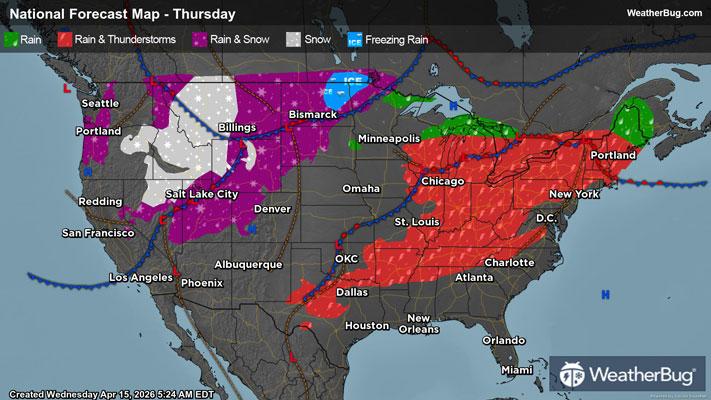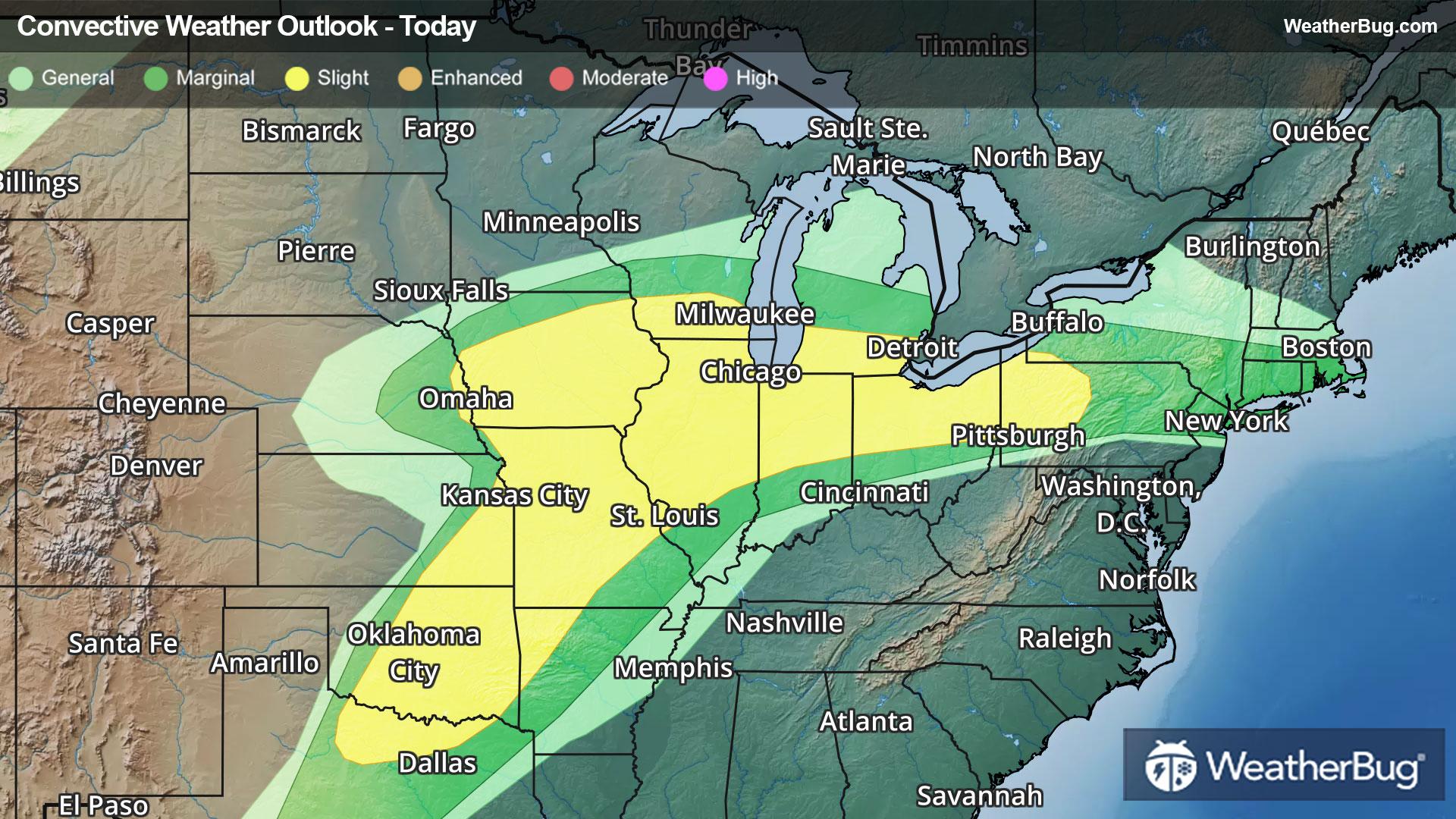
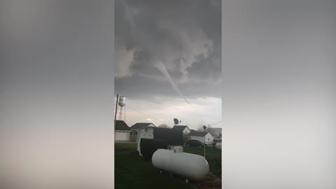
Southern Plains to the Great Lakes on Alert for Severe Storms
Scattered strong thunderstorms are expected from the southern Plains to the lower Great Lakes today.
Read More
Weather Station:HELENA
43degrees Fahrenheit
Feels like:33°F
Hi: 57Lo: 25
70% Chance of Heavy Snow
Lo25°F
Breezy colder. Mostly cloudy early in the evening then becoming partly cloudy. Patchy blowing snow early in the evening. Snow showers likely and slight chance of thunderstorms early in the evening then chance of snow showers late in the evening. Slight chance of snow after midnight. Snow may be heavy at times early in the evening. Visibility one quarter mile or less at times early in the evening. New snow accumulation up to 2 inches. Lows in the lower 20s. West winds 10 to 25 mph decreasing to 10 to 15 mph after midnight. Gusts up to 45 mph. Chance of precipitation 70 percent.
Hi33°F
Colder. Partly sunny. Chance of snow in the morning then snow showers likely in the afternoon. Patchy blowing snow in the afternoon. Snow accumulation up to 2 inches. Total snow accumulation up to 4 inches. Highs 28 to 36. West winds 10 to 15 mph with gusts to around 35 mph. Chance of snow 70 percent.
23 | Fair
8 Medium-High
Closest strike in the last 30 minutes:843.7 miles
No Lightning Nearby