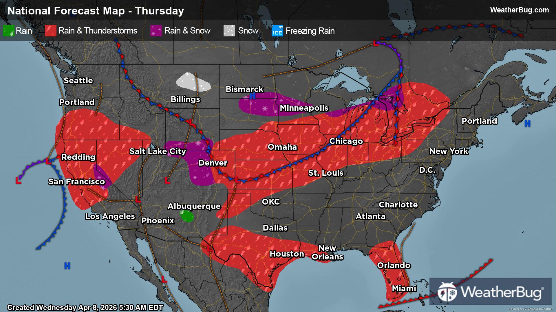
Merrillville, IN Weather

As of

Weather Station:Merrillville Community Schools

Open weather station selector modal

23degrees Fahrenheit

Feels like:8°F

Hi: 25Lo: 18

70% Chance of Heavy Snow

Live Weather Radar

Merrillville, IN weather radar map

Current Weather Details

Windchill
Daily Rain
0"
Dew point
17°
Monthly Rain
0.39"
Humidity
77%
Avg. Wind
NW 19 mph
Pressure
30.39" →
Wind Gust
NW 27 mph
Sunrise
6:33 AM
Moon
Waxing Crescent
Sunset
5:32 PM
UV Index
2 (Low)

Weather Forecast

  • Today

    Hi

    Mostly cloudy. A chance of snow showers until late afternoon. A chance of flurries late. Patchy blowing and drifting snow in the late morning and early afternoon. Snow accumulation up to 1 to 2 inches possible highest in eastern parts of the county. Blustery. Highs in the upper 20s. Northwest winds 15 to 20 mph with gusts up to 30 mph. Chance of precipitation 50 percent.

  • Tonight

    Lo

    Mostly cloudy. A chance of flurries in the evening. Lows around 18. Northwest winds 5 to 10 mph becoming southwest after midnight.

Merrillville, IN 10-day weather forecast

AIR QUALITY

20 | Fair

Top Triggers:pm25
Air quality data provided by Ambee
View Today's Air Quality details for Merrillville, IN

POLLEN COUNT & ALLERGY FORECAST

0.4 Low

Predominant Pollen:Cedar/Juniper
View the Pollen forecast details

LIGHTNING MAP

Closest strike in the last 30 minutes:2644.4 miles

No Lightning Nearby

Real-time lightning alerts & live Map