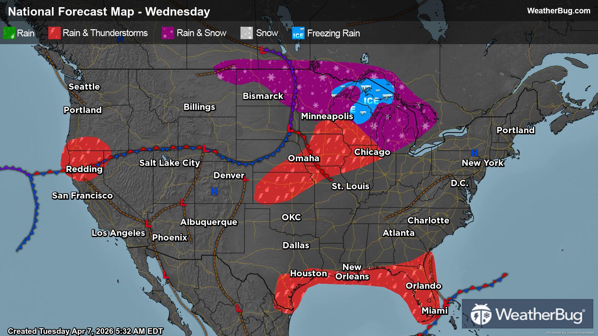
Wednesday's Weather Outlook
Mother Nature provides a typical active spring pattern throughout the U.S. on Wednesday.
Read More
Weather Station:Elkhart Lake Glenbeulah HS
25degrees Fahrenheit
Feels like:19°F
Hi: 25Lo: 25
Mostly Clear
Lo25°F
Partly cloudy until early morning then cloudy with numerous snow showers possibly mixed with rain showers early in the morning. Little snow accumulation. Lows in the upper 20s. South winds 5 to 15 mph. Chance of precipitation 70 percent.
Hi59°F
Not as cool. Breezy. Cloudy in the morning then becoming partly sunny. Numerous light rain showers possibly mixed with snow showers in the morning. No snow accumulation. Highs in the mid 50s near the lake and in the lower 60s inland. South winds 15 to 25 mph. Chance of precipitation 70 percent.
27 | Fair
3.5 Low-Medium
Closest strike in the last 30 minutes:1318.5 miles
No Lightning Nearby


