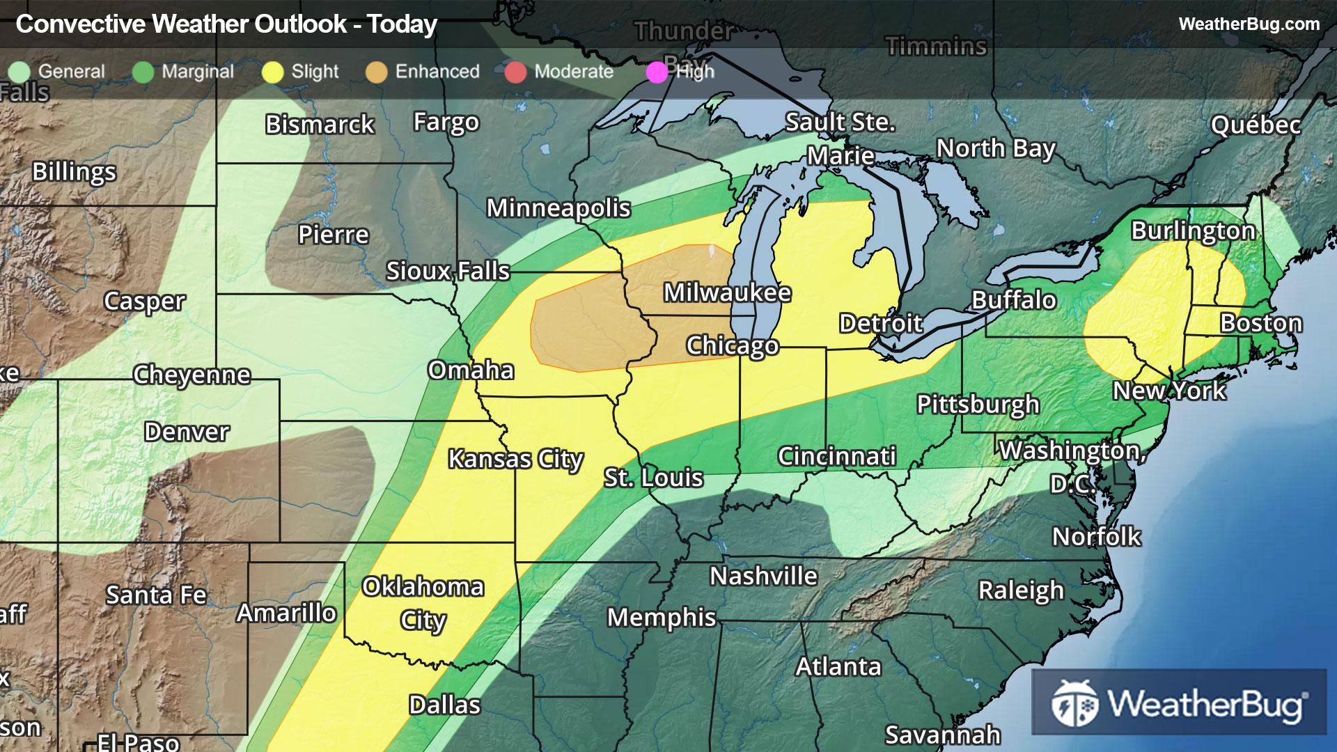
Severe Storms Take Aim at the Northeast, Midwest, Plains
Summer-like warmth and humidity spreading northward will help fuel another round of severe thunderstorms today.
Read More
Weather Station:WeatherBug
46degrees Fahrenheit
Feels like:43°F
Hi: --Lo: 37
70% Chance of Light Rain
Lo37°F
Cloudy with likely rain-snow mix. Chance of precipitation 90%. Low temperature around 37F. Dew point will be around 38F with an average humidity of 95%. Winds will be 8 mph from the W.
Hi41°F
Rain and snow. Snow level near 3500 feet. Snow may be heavy at times in the afternoon. Rainfall amounts one to three inches possible. Snow accumulation near hurricane ridge of 2 to 6 inches.
25 | Fair
6.9 Medium
Closest strike in the last 30 minutes:1448.0 miles
No Lightning Nearby


