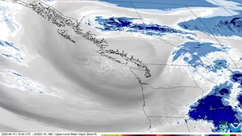
GroundTruthWeatherBug for Advertisers
  • Sign In
  • Press
  • Education
  • Feedback
  • Careers
  • Settings
  • Forecasts
  • Maps
  • Alerts
  • Life
  • News & Videos
  • Cameras
  • Air Quality
  • Hurricane
0
NowHourly10 Day
  • Today's Weather - Rockwall, TX

    Jun 05, 2025 9:22 PM
    Ralph Hall Municipal Arpt
    82°
    Weather forecast icon
    Feels like 88°
    Hi --
    Lo 75°F
    Warm and Humid
  • WEATHER DETAILSRockwall, TX
    • Windchill84°F
      Daily Rain0"
    • Dew Point76°F
      Monthly Rain2.51"
    • Humidity76%
      Avg. WindE 2 mph
    • Pressure29.95"
      Wind Gust2 mph
    • Sunrise6:17 AM
      MoonWaxing Gibbous
    • Sunset8:31 PM
      UV Index8 (Very High)
  • WEATHER FORECASTRockwall, TX
    TonightLo 75°F
    Weather forecast icon
    Mostly cloudy. Lows in the mid 70s. South winds 5 to 10 mph.
    TomorrowHi 90°F
    Mostly sunny. Humid with highs around 90. South winds 5 to 10 mph.
  • Featured Videos
  • Air QualityRockwall, TX
    39 | Fair
    Top Triggers: PM2.5
    Air quality data provided by Ambee
  • POLLEN COUNT & ALLERGY FORECASTRockwall, TX
    ic_pollen_web
    3.6 Low-Medium
    Predominant Pollen:
    Grass and Hickory/Pecan
  • Lightning MapRockwall, TX
    Closest strike in the last 30 minutes: 226.8 miles away
    No Lightning Nearby
    • TOP STORIES
      Dangerous Storms Likely for Central & Southern Plains

      A developing low pressure system will help produce scattered severe thunderstorms across the central and southern Plains today. 

      Upper level moisture, energy aloft, and a developing low pressure at the surface will aid in the development of severe thunderstorms this evening through the overnight hours. Very large hail, damaging winds, and even tornadoes are possible with the greatest tornado threat associated with supercells early on in the event. 

      The Storm Prediction Center currently has a Slight Risk for eastern New Mexico, southeastern Colorado, southwestern Kansas, western Texas, and much of Oklahoma. Cities included are Oklahoma Coty, Carlsbad, N.M., Lamar, Colo., and Amarillo and Midland, Texas.

      The Storm Prediction Center has upgraded to an Enhanced Risk in two separate locations. The southern risk includes Lubbock and Odessa, Texas, and Hobbs, N.M. Large Hail and an increased tornado threat with a chance of a significant tornado (EF-2+) are the highlighted threats in this risk. The northern risk includes Dodge City, Kan., Lamar, Colo., and Guymon and Woodward, Okla. Destructive wind is the highlighted threat in this risk but a tornado or two cannot be ruled out.

      A Tornado Watch is in effect in southeastern Colorado and western Kansas, including Garden City and Elkhart, Kan. An additional Tornado Watch is in effect in western Texas and eastern New Mexico, including Lubbock and Childress, Texas, Roswell, N.M., and Clovis, N.M.

      A Severe Thunderstorm Watch is in effect in southwest Texas including Fort Stockton and Midland. Another Severe Thunderstorm Watch is in effect for eastern Colorado and far western Kansas, including Colorado Springs, Pueblo, and Trinidad, Colo. A third Severe Thunderstorm Watch is in effect for southeast Colorado, southwest Kansas, Oklahoma Pandhandle, and northern Texas Panhandle. 

      The Storm Prediction Center has upgraded central portions of Pennsylvania and New York to a Slight Risk including places like Syracuse and Binghamton, N.Y., and State College, Pa. Damaging wind is the main threat with these storms but hail cannot be ruled out. 

      A Severe Thunderstorm Watch is in effect for south-central New York and northeast Pennsylvania, including Elmira, Ithaca, and Binghamton, N.Y.

      With storms forecast to persist into the night, flooding will also be a concern hence the Flood Watches up for northern Oklahoma, and southeastern Kansas. Many area creeks, streams, and rivers are already spilling over their banks, therefore with 2 to 4 inches of rain tonight and Friday, flash flooding will remain a top concern.

      Make sure to know the difference between a watch and a warning should they become issued. A “watch” means that conditions are favorable for severe weather to occur and to be on alert for any rapidly changing conditions. A “warning” means that severe weather is imminent, and you should act fast to remain safe.

      The best way to remain safe is to stay prepared and informed about your local weather. Have a severe weather kit packed with a battery-operated radio, water, and non-perishable food items should you be without power for long periods of time. Also, check the WeatherBug app frequently for any updates on today's severe weather. Remember, "When Thunder Roars, Go Indoors!"

      Read More
      Friday's Weather Outlook
      Read More
      Weekend Weather Preview
      Read More
      Stormy Springtime Pattern Improves Drought Nationwide
      Read More
      The Tie Between Wildfires and Air Quality
      Read More
      After a Flood: What To Do
      Read More
      MORE NEWS
      • TODAY'S NATIONAL OUTLOOK
      • Hurricane TrackerRockwall, TX
        No Active Hurricanes or Warnings Issued
      • Allergy ForecastRockwall, TX
        • Cold & FluRockwall, TX
        • Snow & Ski ForecastRockwall, TX
    • Fire Updates
      Rockwall, TX
      Local Fire Map
    • Traffic Cameras
      Rockwall, TX
    • Weather Cameras
      Rockwall, TX
      No Weather Cams available in this region
    • Outdoor Sports GuideRockwall, TX
Always Have Access to WeatherBug at Your Fingertips, It's Free.
Connect With Us
© GroundTruth, 2025. WeatherBug is a brand of GroundTruth. All Rights Reserved. Terms | Privacy | Partners | Ad Choices | Sitemap | USA | FAQ | WeatherBug for Advertisers
  • North America
  • South America
  • Africa
  • Europe
  • Asia
  • Australia