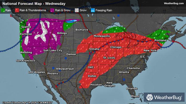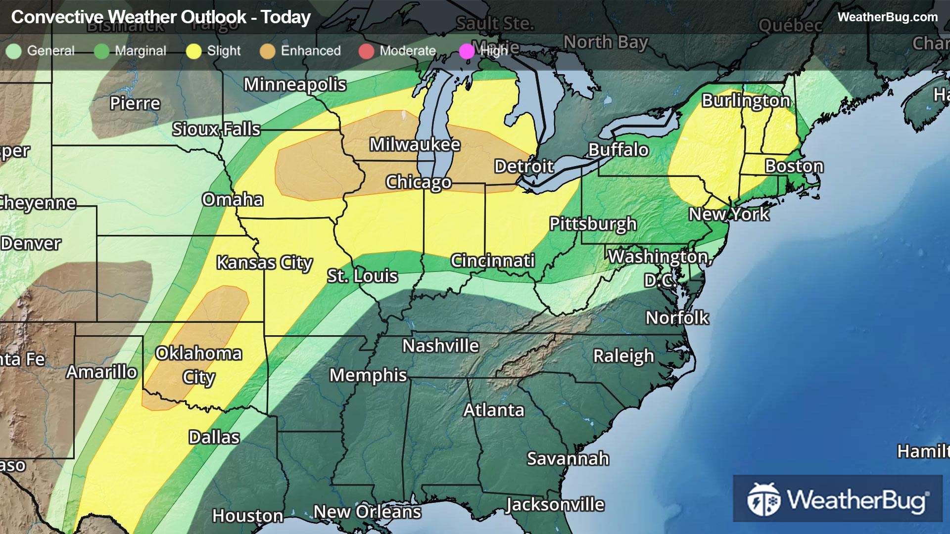
Big Storms Eye Southern Plains to New England Through Tonight
Oodles of dangerous weather will pepper the southern Plains to the Great Lakes, Ohio Valley, and New England.
Read More
Weather Station:Mount Si HS
48degrees Fahrenheit
Feels like:48°F
Hi: 48Lo: 38
Light Rain
Hi47°F
Cloudy with likely rain. Chance of precipitation 100%. High temperature around 47F. Dew point will be around 42F with an average humidity of 92%. Winds will be 7 mph from the S.
Lo38°F
Rain showers and a slight chance of thunderstorms in the evening then a chance of rain and snow after midnight. No snow accumulation. Lows in the mid to upper 30s. South wind 10 to 15 mph with gusts to 35 mph becoming southeast with gusts to 20 mph after midnight.

24 | Fair
6.8 Medium
Closest strike in the last 30 minutes:455.2 miles
No Lightning Nearby