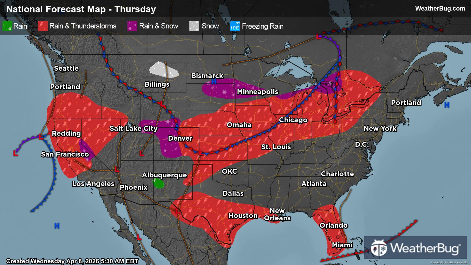
Superior Village, WI Weather

As of

Weather Station:WeatherBug

Open weather station selector modal

21degrees Fahrenheit

Feels like:7°F

Hi: --Lo: 11

Mostly Cloudy

Live Weather Radar

Superior Village, WI weather radar map

Current Weather Details

Windchill
Daily Rain
--"
Dew point
12°
Monthly Rain
1.84"
Humidity
71%
Avg. Wind
N 14 mph
Pressure
--"
Wind Gust
-- mph
Sunrise
7:21 AM
Moon
Waning Crescent
Sunset
7:13 PM
UV Index
2 (Low)

Weather Forecast

  • Tonight

    Lo

    Cloudy. Snow likely late this evening then a chance of snow. Additional snow accumulation around an inch. Total snow accumulation 4 to 6 inches. Much cooler with lows around 8 above. North winds 15 to 20 mph with gusts up to 35 mph. Chance of snow 70 percent. Wind chill values as low as 6 below.

  • Tomorrow

    Hi

    Mostly cloudy in the morning then becoming mostly sunny. Cooler with highs around 18. North winds 15 to 20 mph with gusts up to 30 mph. Wind chill values as low as 10 below in the morning.

Superior Village, WI 10-day weather forecast

AIR QUALITY

25 | Fair

Top Triggers:pm25
Air quality data provided by Ambee
View Today's Air Quality details for Superior Village, WI

POLLEN COUNT & ALLERGY FORECAST

0.1 Low

Predominant Pollen:None
View the Pollen forecast details

LIGHTNING MAP

Closest strike in the last 30 minutes:594.0 miles

No Lightning Nearby

Real-time lightning alerts & live Map