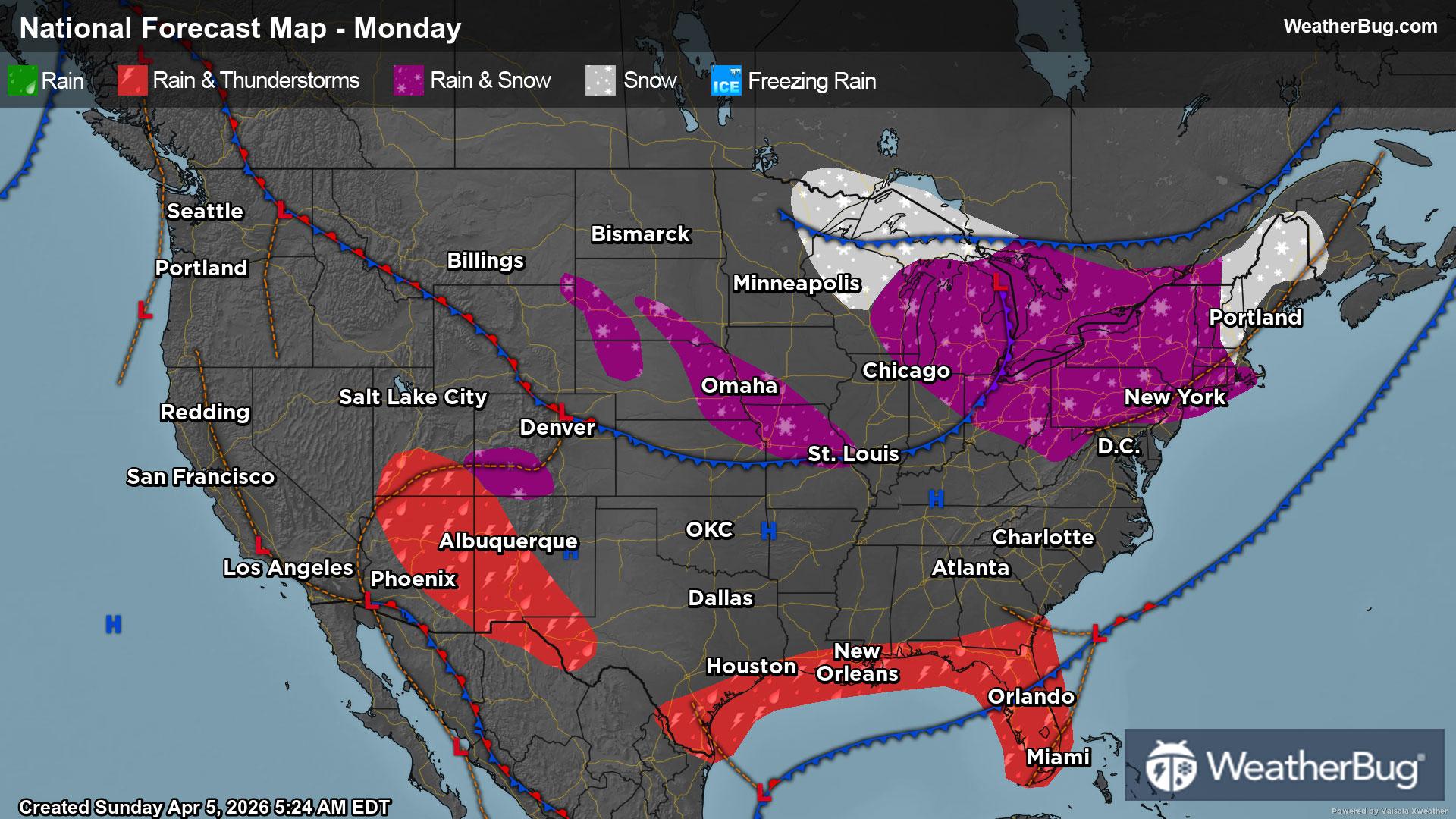
Today's Weather Outlook
The start of the week in April will struggle to feel like spring for much of the country.
Read More
Weather Station:Mequon-Thiensville School Dist
37degrees Fahrenheit
Feels like:32°F
Hi: 44Lo: 22
Mostly Sunny
Hi44°F
Partly sunny. Scattered light rain showers early in the afternoon. Scattered snow showers possibly mixed with rain showers late in the afternoon. Highs in the mid 40s. Northwest winds 10 to 20 mph. Chance of precipitation 50 percent.
Lo22°F
Colder. Mostly cloudy with scattered snow showers through around midnight then mostly clear after midnight. Lows in the lower 20s. North winds 5 to 15 mph. Chance of snow 50 percent.

23 | Fair
8.3 Medium-High
Closest strike in the last 30 minutes:1166.9 miles
No Lightning Nearby


