Today's Weather Outlook
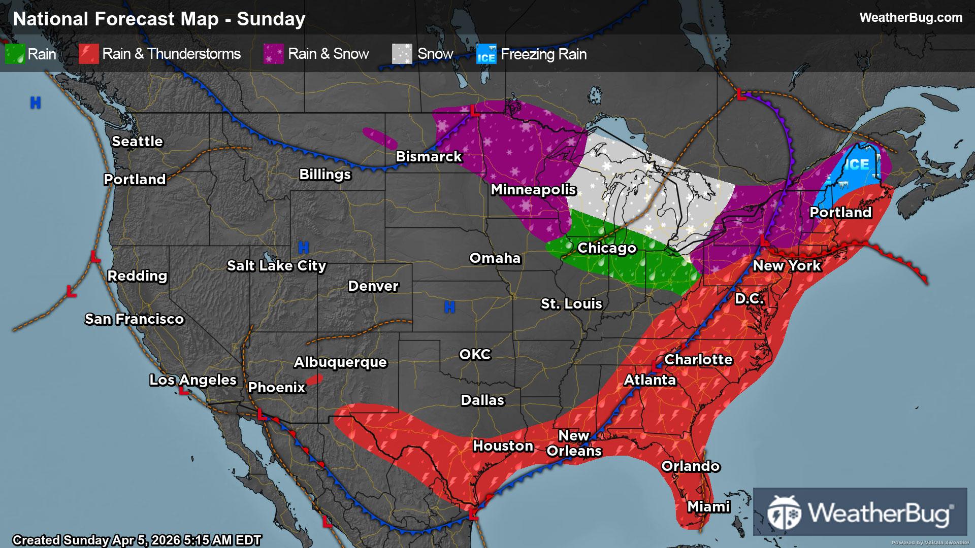
A potent weather system traverses the U.S. this weekend, bringing everything from accumulating snow and ice to rainy, stormy weather.
Read More
Weather Station:Denmark HS
32degrees Fahrenheit
Feels like:25°F
Hi: 36Lo: 32
70% Chance Frozen Mix
Lo33°F
Partly cloudy. Low temperature around 33F. Dew point will be around 29F with an average humidity of 90%. Winds will be 14 mph from the W.
Hi45°F
Blustery. Mostly cloudy in the morning then becoming partly cloudy. Highs in the middle 40s. Northwest wind 15 to 25 mph.

23 | Fair
6.4 Medium
Closest strike in the last 30 minutes:1032.0 miles
No Lightning Nearby


