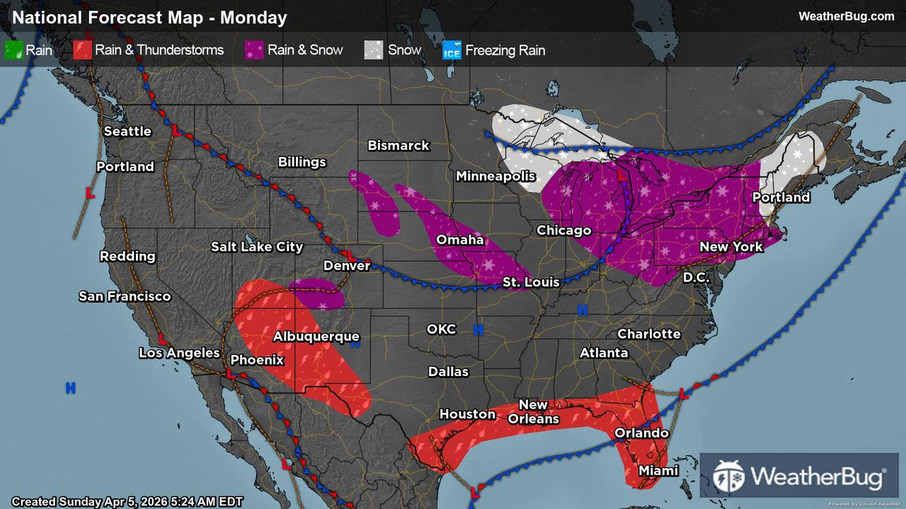
Vermont, WI Weather

As of

Weather Station:Eagle School

Open weather station selector modal

44degrees Fahrenheit

Feels like:36°F

Hi: 48Lo: 35

Mostly Sunny

Live Weather Radar

Vermont, WI weather radar map

Current Weather Details

Windchill
38°
Daily Rain
0"
Dew point
17°
Monthly Rain
2.14"
Humidity
32%
Avg. Wind
NW 17 mph
Pressure
30.17" →
Wind Gust
17 mph
Sunrise
6:34 AM
Moon
Waning Gibbous
Sunset
7:29 PM
UV Index
6 (High)

Weather Forecast

  • Today

    Hi

    Partly sunny. Highs in the lower 50s. Northwest winds 10 to 15 mph.

  • Tonight

    Lo

    Cloudy. A 50 percent chance of light rain showers through around midnight. Lows in the mid 30s. Northwest winds 5 to 15 mph.

Vermont, WI 10-day weather forecast

AIR QUALITY

26 | Fair

Top Triggers:pm25
Air quality data provided by Ambee
View Today's Air Quality details for Vermont, WI

POLLEN COUNT & ALLERGY FORECAST

9 Medium-High

Predominant Pollen:Maple, Cedar/Juniper and Elm.
View the Pollen forecast details

LIGHTNING MAP

Closest strike in the last 30 minutes:802.4 miles

No Lightning Nearby

Real-time lightning alerts & live Map