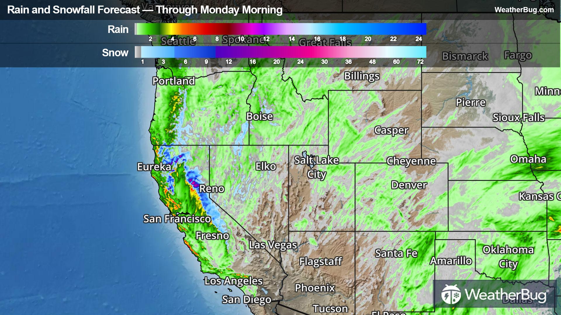
Weatherly, PA Weather

As of

Weather Station:Hazleton Regional Arpt 1600 ft elev

Open weather station selector modal

28degrees Fahrenheit

Feels like:20°F

Hi: 28Lo: 28

70% Chance of Heavy Snow

Live Weather Radar

Weatherly, PA weather radar map

Current Weather Details

Windchill
20°
Daily Rain
0"
Dew point
27°
Monthly Rain
0.54"
Humidity
93%
Avg. Wind
NW 9 mph
Pressure
29.67" →
Wind Gust
18 mph
Sunrise
6:46 AM
Moon
Waxing Crescent
Sunset
5:47 PM
UV Index
2 (Low)

Weather Forecast

  • Tonight

    Lo

    Snow. Areas of blowing snow. Snow may be heavy at times. Snow accumulation of 4 to 8 inches. Cold with lows in the mid 20s. North winds 15 to 20 mph. Gusts up to 30 mph increasing to 45 mph after midnight. Chance of snow near 100 percent.

  • Tomorrow

    Hi

    Mostly cloudy. Snow mainly in the morning. Areas of blowing snow. Snow may be heavy at times in the morning. Total snow accumulation of 8 to 12 inches. Blustery cold with highs in the lower 30s. North winds 15 to 25 mph with gusts up to 45 mph. Chance of snow 80 percent.

Weatherly, PA 10-day weather forecast

AIR QUALITY

23 | Fair

Top Triggers:pm25
Air quality data provided by Ambee
View Today's Air Quality details for Weatherly, PA

POLLEN COUNT & ALLERGY FORECAST

0.5 Low

Predominant Pollen:Mixed Trace
View the Pollen forecast details

LIGHTNING MAP

Closest strike in the last 30 minutes:439.6 miles

No Lightning Nearby

Real-time lightning alerts & live Map