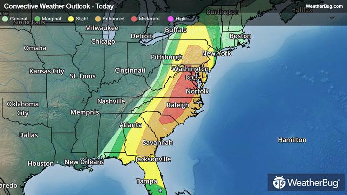
Dangerous Storms Take Aim At The Eastern U.S.
After more than 400 reports of severe weather on Sunday, a greater risk of dangerous thunderstorms exists today.
Read More
Weather Station:WeatherBug
19degrees Fahrenheit
Feels like:5°F
Hi: 23Lo: 12
70% Chance of Heavy Snow
Hi23°F
Colder windy. Snow in the morning then chance of light snow in the afternoon. Areas of blowing snow through the day. Snow accumulation of 1 to 3 inches. Total snow accumulation 1 to 6 inches. Near steady temperature in the lower 20s. Northwest winds 20 to 30 mph with gusts to around 45 mph. Chance of snow near 100 percent.
Lo7°F
Colder. Mostly cloudy in the evening then becoming partly cloudy. Patchy blowing snow in the evening. Lows around 6. Northwest winds 10 to 20 mph. Gusts up to 35 mph through around midnight.

26 | Fair
0.6 Low
Closest strike in the last 30 minutes:568.9 miles
No Lightning Nearby


