
Beneficial Rain And Snow Coming To The West
Multiple storm systems will bring much-needed rain and snow to parts of the West Coast through this weekend.
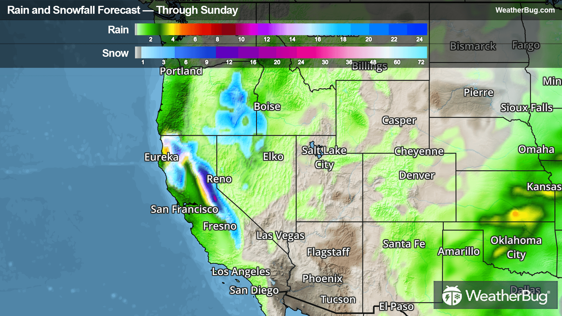
The first disturbance will push into Washington and northern California today, which will gradually spread into central California and the Great Basin on Friday. The northern Sierras, Klamath Mountains, and the Cascades in Oregon will see the most rain and mountain snow today through Friday, with rainfall of 0.5 to 1.5 inches likely. Snow amounts will be rather small and limited to the highest elevations of the northern Sierras, which could receive 2 to 6 inches of snow.
A stronger storm system containing more moisture will impact the same regions Saturday into Sunday. Periods of moderate to heavy rain and mountain snow are expected from western Oregon to central California, with lighter amounts extending into southern California, the Great Basin, and Washington.
The lower elevations from western Oregon to central California will see widespread rainfall of 0.5 to 1.5 inches over the weekend, with locally higher amounts of 2 to 3 inches. Above 4500 feet, snowfall on the order of 1 to 2 feet is in the forecast for much of the Sierra Nevada and the Klamath Mountains. The mountaintops could see even higher amounts up to 3 to 4 feet!
Winter Storm Watches cover much of the Sierra Nevada for this weekend's storm system.
Be sure to download the WeatherBug app to stay up to date on the latest on this changing weather. It’s never too early to have a supply kit packed in case of inclement weather. A simple kit including a weather radio, water, blankets, batteries, and non-perishable food items will go a long way in the event of a power outage. It’s always best to avoid traveling in rough weather as the roads will be dangerous.