
Snow And A Wintry Mix Hit The Northeastern U.S.
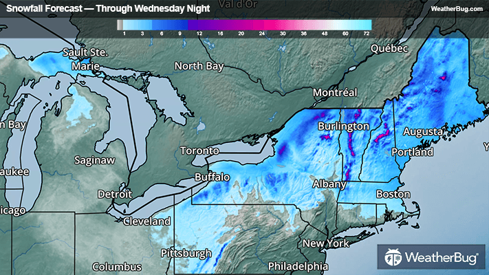
Light to moderate snow will spread across the northern Great Lakes to New England through midweek, with most of the snow winding down by Wednesday night.
A disturbance racing southeastward across Ontario will make its way across the Upper Great Lakes and into the Northeast today, producing a mix of rain, freezing rain, and snow.
Most of New York and New England will see light to moderate snow as this system speeds through today into tonight, with some lingering snow showers lasting through Wednesday night. Pennsylvania will see rain changing over to snow tonight, with mostly rain showers expected in New Jersey and New York City.
Much of New England and Upstate New York will receive 1 to 4 inches of snowfall, but higher amounts of 4 to 7 inches are possible from northern and central New York to northern New England. Winter Weather Advisories and Winter Storm Warnings have been issued for much of the Northeast as well as the central Appalachians.
Areas of freezing rain could occur from central New York and northeastern Pennsylvania into southwestern New England, but ice accumulations would be light, with a glaze to a tenth of an inch of ice possible.
Be sure to keep up with the latest watches and warnings from your local weather sources or by downloading the WeatherBug app.