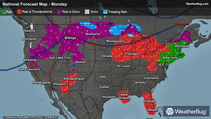
Severe Storms Enter the Great Lakes
A burgeoning low pressure system will pull together isolated severe thunderstorms across the Lower Great Lakes region from this evening through Tuesday.
Over the Upper Midwest, an upper-level disturbance will drift over a stationary front this evening, where Gulf moisture is already shoving against a drier Canadian air mass. These ingredients will lead to a new low-pressure system, and under such an unstable environment, isolated severe thunderstorms will begin to ignite.
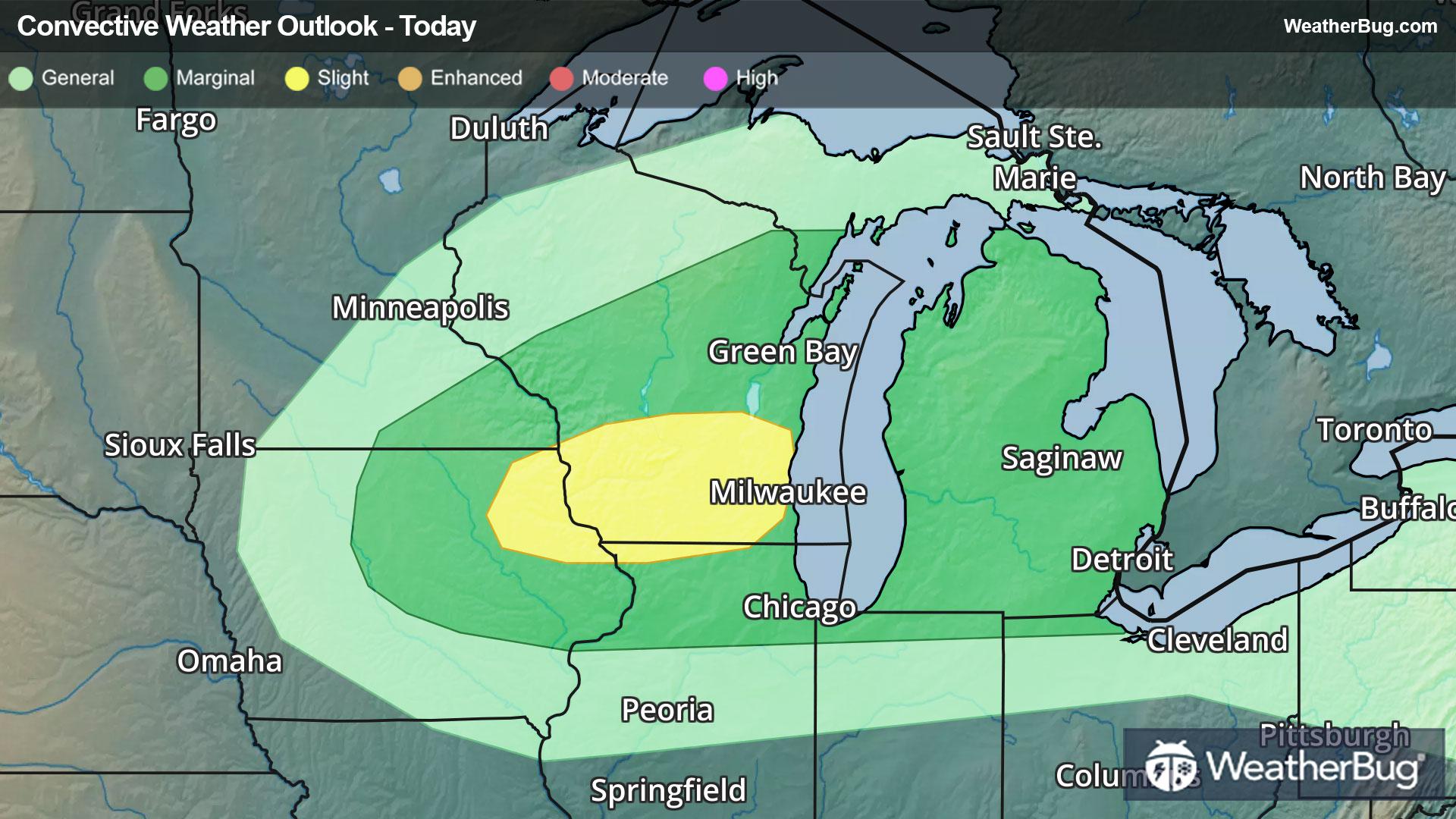
According to the Storm Prediction Center, there is a Slight Risk (a 2 out of 5 on the severity scale) for northeastern Iowa and southern Wisconsin this evening. Cities within this risk region include Milwaukee, Madison, and Janesville, Wis., where the environment will mainly support widely scattered hailstorms and likely isolated damaging winds.
A weaker Marginal Risk (a 1 out of 5 on the severity scale) will envelop areas from central Iowa and southeastern Minnesota early this evening through northern Illinois and Michigan’s Lower Peninsula overnight. Major urban areas like Chicago, Detroit, and even Toledo, Ohio, could see a few hail or damaging wind reports through tonight.
As the low pressure system deepens on Tuesday, the coverage and intensity of severe weather along its path will increase as well.
On Tuesday, another Slight Risk has been posted for much of the Lower Great Lakes region from eastern Illinois through western New York. Cities such as Fort Wayne, Ind., Detroit, Cleveland and Toledo, Ohio, Erie, Penn., and Buffalo, N.Y. are within the risk area. Widely scattered hailstorms and damaging winds are likely, and furthermore, the ingredients for isolated tornadoes will be present.
A larger Marginal Risk on Tuesday currently spans from eastern Iowa through central New York and northern Pennsylvania, including the cities of Milwaukee, Wis., Chicago, and Rochester, N.Y.
Make sure to know the difference between a watch and a warning should they be issued. A "watch" means that conditions are favorable for severe weather to occur, and to be on alert for any rapidly changing conditions. A "warning" means that severe weather is imminent, and you should act fast to remain safe.
The best way to remain safe is to stay prepared and informed about your local weather. Have a severe weather kit packed with a battery-operated radio, water, and non-perishable food items. Also, check the WeatherBug app frequently for any updates on today's severe weather. Remember, "When Thunder Roars, Go Indoors!