Severe Thunderstorms Shift to Ohio Valley, Central Texas
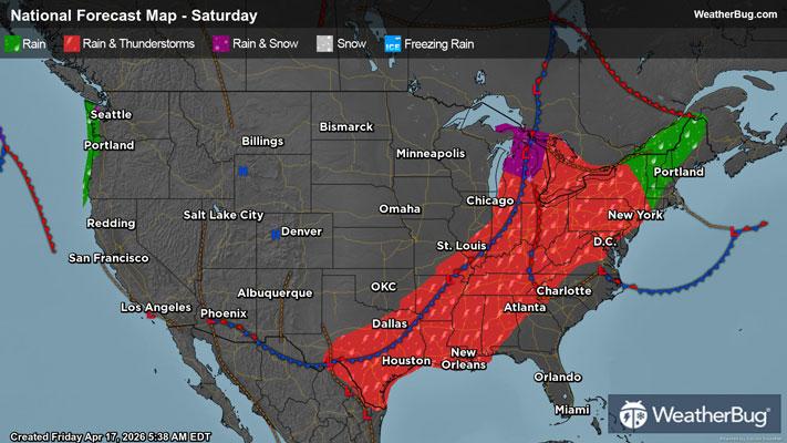
The last round of severe thunderstorms in an active pattern across the Central U.S. will target the Upper Ohio Valley, and to a lesser extent, central Texas today.
Persistent high pressure in the Southeast is continuing to siphon warm Gulf air into the Ohio Valley and far southern Plains ahead of a strong cold front. Combined with ample upper-level energy revolving overhead with the front, the ingredients for severe storms will synergize today.
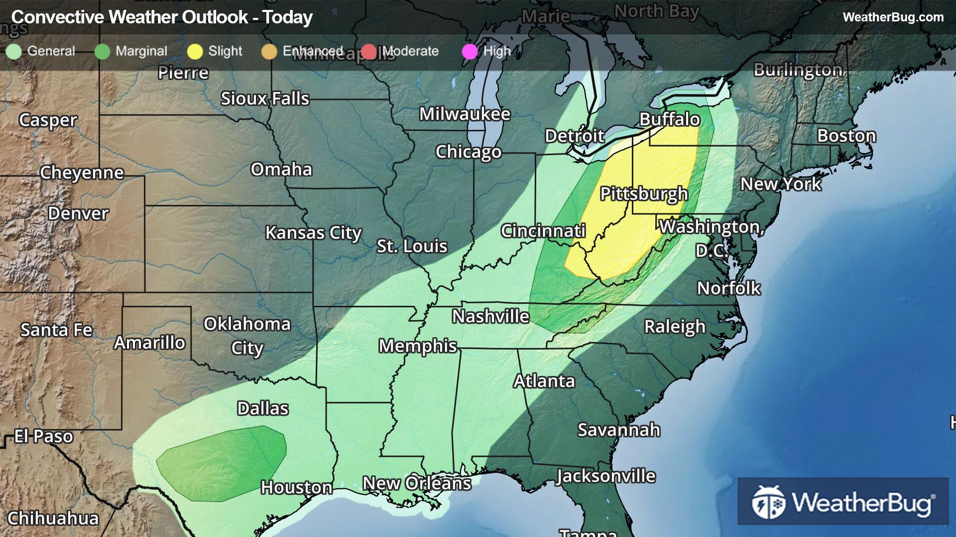
The government's Storm Prediction Center has issued a Slight Risk, or a 2 out of 5 on the severe weather probability scale, for eastern Kentucky and much of West Virginia through Lake Erie and southwestern New York. Cities such as Buffalo, N.Y., Pittsburgh and Erie, Pa., Akron and Youngstown, Ohio, and Charleston, W.V., fall under the region. Widely scattered severe thunderstorms are expected here, bringing threats for damaging winds, large hail, and even a few tornadoes.
Additionally, two separate Marginal Risks, or a 1 out of 5 on the severe weather probability scale, are posted for today. One region envelops the Slight Risk and extends southward into eastern Tennessee, including the cities of Rochester, N.Y., Cleveland and Columbus, Ohio, Lexington, Ky., and Kingsport, Tenn. Stray thunderstorms could produce damaging winds here.
The second Marginal Risk region covers parts of central Texas, including San Antonio and Austin. Here, a few elevated thunderstorms will be capable of producing large hail.
As the cold front expands south and east of Appalachia on Sunday, poor timing and a lack of ingredients will inhibit severe weather. Cooler, breezy, and eventually dry weather will fill in behind the front.
Make sure to know the difference between a watch and a warning should they be issued. A "watch" means that conditions are favorable for severe weather to occur, and to be on alert for any rapidly changing conditions. A "warning" means that severe weather is imminent, and you should act fast to remain safe.
The best way to remain safe is to stay prepared and informed about your local weather. Have a severe weather kit packed with a battery-operated radio, water, and non-perishable food items. Also, check the WeatherBug app frequently for any updates on today's severe weather. Remember, "When Thunder Roars, Go Indoors!"