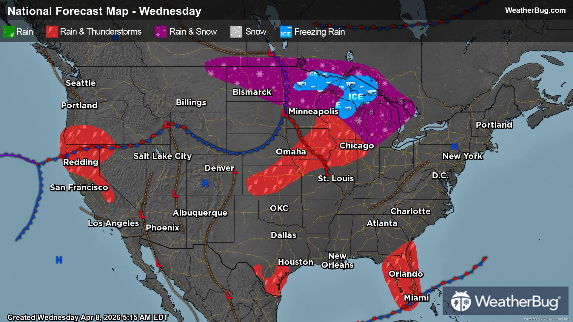
Scattered storms populate the Plains and Rockies as a low-pressure system drifts up the East Coast.
The Rockies and Plains will continue its wet stretch with showers and storms. Energy throughout the atmosphere overtop ample moisture will promote strong storms across the western Plains. Large hail, damaging wind gusts, and a few tornadoes are possible.
Broad low-pressure continues in Southern California and will lead to showers and storms in the Four Corners. The storms will stay mainly confined to the higher elevations. Snow is possible on the tallest peaks. Lower elevation Arizona, California, and western New Mexico will remain dry.
A weak low pressure moves up the East Coast slowly bringing heavy rain and storms to the Carolinas. Periods of steady rain and scattered storms will occur all day. The closer to the coast of these states, the heavier the totals of rain will be. Somewhere in the range of 1 to 3 inches of rain is expected.
Places like the Gulf Coast, Mid-South, Mid-Atlantic, Midwest, and eastern Great Lakes will have a general storm risk. Damaging wind gusts, hail, and flash flooding are the main threats.
Dry weather continues across the West Coast, and Pacific Northwest as temperatures will rise to highs not seen in some time. The Northeast especially closer to the coast will continue to stay dry but that will likely change in the days to follow.
Highs in the 40s and 50s will occur in the higher elevation Rockies and in parts of the Northern Plains. Rain-cooled 60s will be found in the eastern Great Lakes and in portions of the Mid-Atlantic east of the Appalachians. The Midwest, Mid-South, central Plains, and Southeast along the Atlantic Coast will see 70s. The West Coast and surprisingly the Pacific Northwest will see 80s especially in the lower elevations. Eighties and 90s will be common across the Northeast, Gulf Coast, central Texas, and southern portions of New Mexico, Arizona, and California.