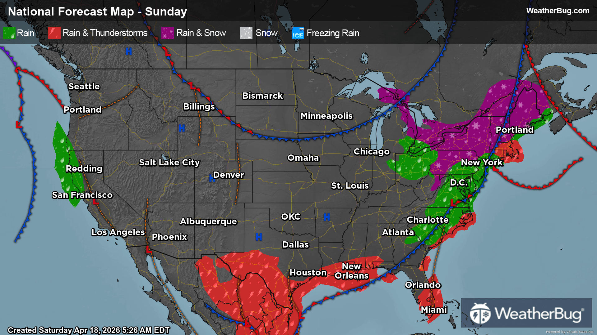
Damaging severe thunderstorms continue to wreck parts of the South, just a day after deadly twisters in Kentucky. As if that weren’t enough, severe thunderstorms are also pummeling northern New England.
The storms are forming along a cold front stretching across the Deep South. A separate system extends across southern Canada into New England. The result is a warm and moist atmosphere ahead of the front and a seasonable air mass behind the front.
A Tornado Watch has been issued for northern Texas and much of Oklahoma, including Oklahoma City, and Wichita Falls, Texas. Severe Thunderstorm Watches extend from northern Texas to the Rio Grande Valley, encompassing Dallas, Waco, Junction and Del Rio.
The primary threat with any of these storms will be large and damaging winds, which could be as high as 70 to 80 mph. Within the tornado watch, a few tornadoes are possible as well. The threat is significant enough that the national Storm Prediction Center considers it an Enhanced Risk for severe thunderstorms, a level 3 of 5 threat from northern Texas into southern Oklahoma and the Arklatex. A Slight Risk, or level 2 of 5, envelops much of Oklahoma and Arkansas.
Further to the north and east, large thunderstorms are booming across upstate New York and northern New England. Associated with the low pressure system of the Deep South front, these storms are producing damaging winds along and north of I-90 in New York and along the shores of Lake Champlain in Vermont.
A Severe Thunderstorm Watch remains in place from northeastern New York to western New Hampshire, including Albany and Plattsburgh, N.Y., Burlington and Brattleboro, Vt., and Keene, N.H.
Today’s thunderstorms come on the heels of a tornado outbreak that has left dozens dead in Kentucky and produced damaging winds from the Plains to the Mid-Atlantic.