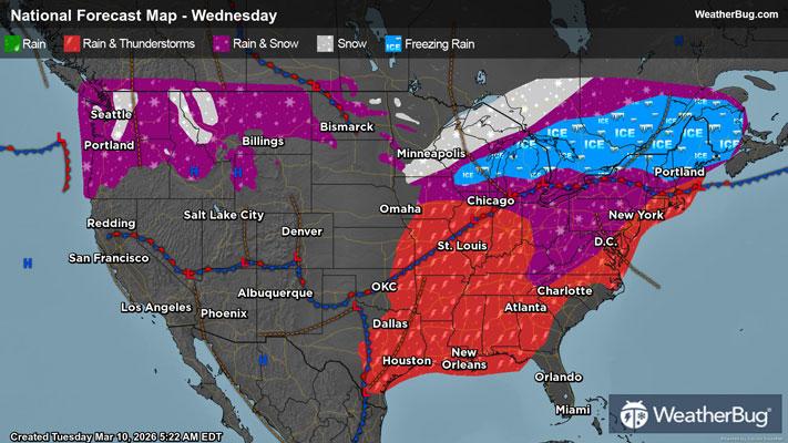
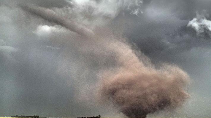
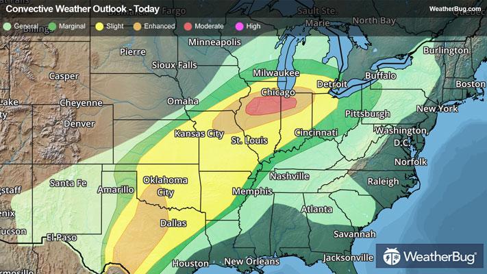
Tropical Storm Erin should slowly strengthen while motoring westward across the central Atlantic, potentially becoming a major hurricane this weekend.
As of 11 p.m. AST/EDT, Tropical Storm Erin was located at 16.7N and 40.1W, or about 1,520 miles east of the northern Leeward Islands. Erin is packing top winds of 45 mph and is racing west at 20 mph. Erin’s minimum central pressure has dropped to 1004 mb, or 29.65 inches of mercury.
Erin is the season’s fifth named storm, and is forecast to slowly strengthen, becoming a hurricane late on Thursday. Erin will maintain a westerly course through Thursday before turning west-northwest between Friday and Sunday. On this track, Erin will pass near or just north of the Leeward Islands this weekend.
Erin will gradually enter an environment more conducive for development during the next day or so. Given Erin’s organization, increasingly warmer waters in its path, and a favorable environment aloft, strengthening could occur at a faster pace later this week through next weekend. By Sunday, Erin might not only be the season’s first hurricane but could double-dip, becoming the first major hurricane also.
Even though Erin is not a direct threat to land during this time, everyone along the Eastern U.S. coast should monitor future forecasts closely. Rip currents will become an increasing risk, which will persist or worsen through the middle of next week. Rip currents have led to more than twenty lives lost this year. If taking a trip to the beach, make sure to swim near a lifeguard or avoid swimming in the ocean if rip currents are present.
Regardless of whether or not this system will make landfall, now is the time to prepare for the hurricane season. Have a “go-bag” ready with chargers, water, food and other necessities. Also, take the time to scope out multiple evacuation routes, in case your preferred one is traffic-jammed or blocked.